
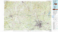
~ Winston Salem NC topo map, 1:100000 scale, 30 X 60 Minute, Historical, 1984, updated 1991
Winston Salem, North Carolina, USGS topographic map dated 1984.
Includes geographic coordinates (latitude and longitude). This topographic map is suitable for hiking, camping, and exploring, or framing it as a wall map.
Printed on-demand using high resolution imagery, on heavy weight and acid free paper, or alternatively on a variety of synthetic materials.
Topos available on paper, Waterproof, Poly, or Tyvek. Usually shipping rolled, unless combined with other folded maps in one order.
- Product Number: USGS-5374880
- Free digital map download (high-resolution, GeoPDF): Winston Salem, North Carolina (file size: 34 MB)
- Map Size: please refer to the dimensions of the GeoPDF map above
- Weight (paper map): ca. 55 grams
- Map Type: POD USGS Topographic Map
- Map Series: HTMC
- Map Verison: Historical
- Cell ID: 68609
- Scan ID: 161819
- Imprint Year: 1991
- Woodland Tint: Yes
- Aerial Photo Year: 1980
- Edit Year: 1982
- Datum: NAD27
- Map Projection: Universal Transverse Mercator
- Map published by United States Geological Survey
- Map Language: English
- Scanner Resolution: 600 dpi
- Map Cell Name: Winston-Salem
- Grid size: 30 X 60 Minute
- Date on map: 1984
- Map Scale: 1:100000
- Geographical region: North Carolina, United States
Neighboring Maps:
All neighboring USGS topo maps are available for sale online at a variety of scales.
Spatial coverage:
Topo map Winston Salem, North Carolina, covers the geographical area associated the following places:
- Brookwood - Swan Creek - Smithtown - New Castle - Poplar Springs - Benefit (historical) - West Salem - Abotts Creek (historical) - Day Acres - Holly Springs - Five Forks - Forbush - Morningside Manor - Waterford - Allin (historical) - Jennings - Teaguetown - Shacktown - Courtney - Old Hollow Estates - Bonanza Hills - Branon - Eaglewood - White Road (historical) - Glennwood Acres - Shady Grove - New Home (historical) - Nebo - Sherwood Forest - Greystone Forest - Boones Hill - Merriweather Estates - Chisman (historical) - Indian Grove - Ross Store - Dodgetown - Union Grove - West Oaks - Harmony Grove - Windy Gap - Reynolda Park - Talleys Crossing - Brown Mountain - Christy Acres - Oak Grove - Colfax - The Meadows - Mill Brook - White Plains - Farmington - Thurmond - Buffalo - Dillard - Bon Air - Red Brush - Clingman - West Highlands - Lewisville - Chalk Level (historical) - North Winston - Zephyr - Pfafftown - Chestnut Grove - East Bend - Columbia Heights - Kernersville - Chestnut Trails - Arlington - New Hope - Brooks Crossroads - Union Cross - Center - Sedges Garden (historical) - Union Cross - Pilot Mountain - Robin Hood Trace - Belews Creek - Sun Meadows - Shalimar - Cutters Creek - Timber Trails - Wood Lee - Reynolda - Dan River Shores - Hootstown - Roaring Gap - Rural Hall - Cliffwood - Seward - Zion (historical) - Oak Grove - Shoals - Fox Run - Johnstown - Fox Hall - Buena Vista - Hills Grove - Ladonia - Pebble Creek Estates - Ceramic (historical)
- Map Area ID: AREA36.536-81-80
- Northwest corner Lat/Long code: USGSNW36.5-81
- Northeast corner Lat/Long code: USGSNE36.5-80
- Southwest corner Lat/Long code: USGSSW36-81
- Southeast corner Lat/Long code: USGSSE36-80
- Northern map edge Latitude: 36.5
- Southern map edge Latitude: 36
- Western map edge Longitude: -81
- Eastern map edge Longitude: -80


