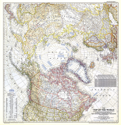
1949 Top of the World Map
In the October 1949 issue of National Geographic, there were five articles related to polar exploration. The Top of the World map, first published in October of 1949, offers a truly unique view that features the Arctic Polar Region at its center. This beautiful map is both a cartographic masterpiece and a fresh look at the world.
- Product Number: PODHNG_ARC_49
- Reference Product Number: 2321342M
- ISBN: - None -
- Date of Publication: 6/1/1949
- Unfolded (flat) Size: 29.5 inches high by 28.5 inches wide
- Map format: Wall
- Map type: Trade Maps - Wall Art


