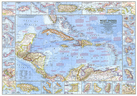
1970 West Indies and Central America Map
This wonderfully detailed map of the West Indies and Central America includes inset maps of over thirty islands, four cities, and the Panama Canal. A particularly unique feature of this map is the splashdown points of various space missions. Published in January 1970 to accompany the article The Netherlands Antilles: Holland in the Caribbean.
- Product Number: PODHNG_AMER_C_70
- Reference Product Number: 2321554M
- ISBN: - None -
- Date of Publication: 6/1/1970
- Unfolded (flat) Size: 26.5 inches high by 38 inches wide
- Map format: Wall
- Map type: Trade Maps - Political

