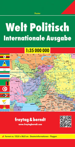
World political, World map 1:35,000,000, international edition
Folded political map of the world from Freytag & Berndt with countries shown in pleasant bright colours against a light blue seas, with a border of flags of countries and major international organizations (US, EU, etc). Names of countries, towns, oceans and other geographical features are in their English versions.
The map shows the network of main road and rail connections, and within USA, Canada, Brazil and Australia indicates state/provincial boundaries. Polar Regions are shown on insets. Latitude and longitude lines are drawn at 10º intervals. Surrounding them map are panels with flags, indicating for each country its area and population.
- Product Number: FB_WOR_INT_15
- Reference Product Number: - None -
- ISBN: 9783707914559
- Date of Publication: 10/1/2015
- Folded Size: 10.02 inches high by 5.11 inches wide
- Unfolded (flat) Size: 10.02 inches high by 5.11 inches wide
- Map format: Folded
- Map type: Trade Maps - Political