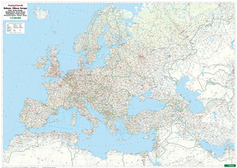
Rails + ferries Europe map 1:5.500,000, wall map, flat
The freytag & berndt railway map Europe stretches from the North Cape to the Red Sea and from Marrakech to Tashkent. It has been developed for railway enthusiasts, tracers and interrailers and shows, in addition to the railway lines, high-speed routes and ferry connections. At the back of the map are the most important international train connections between the main cities.
- Product Number: FB_EUR_RAIL_WA_17
- Reference Product Number: - None -
- ISBN: 9783707917185
- Date of Publication: 5/15/2017
- Folded Size: 35.37 inches high by 48.73 inches wide
- Unfolded (flat) Size: 35.37 inches high by 48.73 inches wide
- Map format: Folded
- Map type: Trade Maps - Railway