
023I13W Marion Lake Canada topo map, 1:50,000 scale
023I13W Marion Lake NRCAN topographic map.
Includes UTM and GPS geographic coordinates (latitude and longitude). This 50k scale map is suitable for hiking, camping, and exploring, or you could frame it as a wall map.
Printed on-demand using high resolution, on heavy weight and acid free paper, or as an upgrade on a variety of synthetic materials.
Topos available on paper, Waterproof, Poly, or Tyvek. Usually shipping rolled, unless combined with other folded maps in one order.
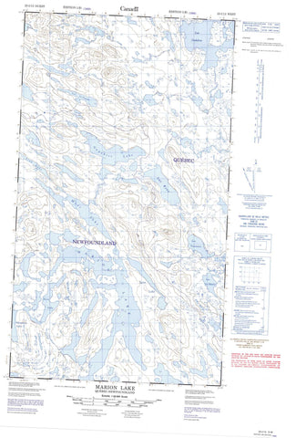
- Halfsheet: This map was designed as a half sheet of NRCAN-023I13, and it is the Western half. Find the eastern half sheet here.
- Product Number: NRCAN-023I13W
- Parent Topo: TOPO-023I
- Map ID also known as: 023I13, 23I13
- Unfolded Size: Approximately 26" high by 36" wide
- Weight (paper map): ca. 55 grams
- Map Type: POD NRCAN Topographic Map
- Map Scale: 1:50,000
- Geographical region: Newfoundland and Labrador, Canada
Neighboring Maps:
All neighboring Canadian topo maps are available for sale online at 1:50,000 scale.
Purchase the smaller scale map covering this area: Topo-023I
Spatial coverage:
Topo map sheet 023I13W Marion Lake covers the following places:
- Gauthier Lake - Keco Lake - Lac Alonce - Lac Arjay - Lac Bonnet - Lac Bonnivet - Lac Buzançois - Lac Chabot - Lac Charny - Lac Civille - Lac Dauphine - Lac Godefroy - Lac Gouffier - Lac Indian - Lac Jallaut - Lac La Rouvillière - Lac La Touche - Lac Le Gras - Lac Le Maire - Lac Marion - Lac Prud'homme - Lac Roymart - Lac Rucelai - Lac Ryan - Lac Tantouin - Lac Verrazano - Lac Villebois - Lac Villedonné - Lean Lake - Link Lake - Marion Lake - Moss Lake - Mountain Lake


