
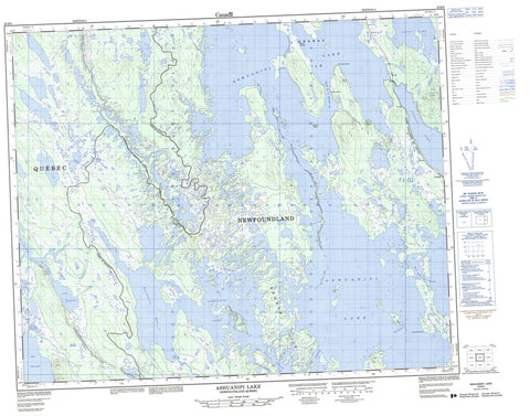
023B09 Ashuanipi Lake Canada topo map, 1:50,000 scale
023B09 Ashuanipi Lake NRCAN topographic map.
Includes UTM and GPS geographic coordinates (latitude and longitude). This 50k scale map is suitable for hiking, camping, and exploring, or you could frame it as a wall map.
Printed on-demand using high resolution, on heavy weight and acid free paper, or as an upgrade on a variety of synthetic materials.
Topos available on paper, Waterproof, Poly, or Tyvek. Usually shipping rolled, unless combined with other folded maps in one order.
- Product Number: NRCAN-023B09
- Parent Topo: TOPO-023B
- Map ID also known as: 023B09, 23B9, 23B09
- Unfolded Size: Approximately 26" high by 36" wide
- Weight (paper map): ca. 55 grams
- Map Type: POD NRCAN Topographic Map
- Map Scale: 1:50,000
- Geographical region: Newfoundland and Labrador, Canada
Neighboring Maps:
All neighboring Canadian topo maps are available for sale online at 1:50,000 scale.
Purchase the smaller scale map covering this area: Topo-023B
Spatial coverage:
Topo map sheet 023B09 Ashuanipi Lake covers the following places:
- Baie des Roches - Northwest Bay - Batture de Foin - Cap du Rocher - Pointe de la Butte - Pointe de Sable - Pointe des Roches - Ashuanipi Pass - Kapitagas Channel - Passe de la Grande Ile - Petite passe aux Outardes - Grande Ile - Grosse Ile - Île de la Cache - Ile Hélène - Ashuanipi Lake - Lac aux Outardes - Lac du Petit Portage - Lac Gagné - Lac Opocopa - Nowell Lake - Racey Lake - Cap de Roche - Cap de Roche (Hill) - Redfir Lake-Kapitagas Channel - Petite rivière aux Goélands - Rivière aux Esquimaux - Rivière Dufresne


