
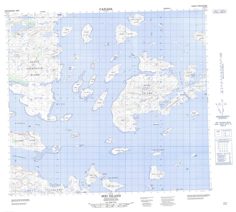
014C11 Dog Island Canada topo map, 1:50,000 scale
014C11 Dog Island NRCAN topographic map.
Includes UTM and GPS geographic coordinates (latitude and longitude). This 50k scale map is suitable for hiking, camping, and exploring, or you could frame it as a wall map.
Printed on-demand using high resolution, on heavy weight and acid free paper, or as an upgrade on a variety of synthetic materials.
Topos available on paper, Waterproof, Poly, or Tyvek. Usually shipping rolled, unless combined with other folded maps in one order.
- Product Number: NRCAN-014C11
- Parent Topo: TOPO-014C
- Map ID also known as: 014C11, 14C11
- Unfolded Size: Approximately 26" high by 36" wide
- Weight (paper map): ca. 55 grams
- Map Type: POD NRCAN Topographic Map
- Map Scale: 1:50,000
- Geographical region: Newfoundland and Labrador, Canada
Neighboring Maps:
All neighboring Canadian topo maps are available for sale online at 1:50,000 scale.
Purchase the smaller scale map covering this area: Topo-014C
Spatial coverage:
Topo map sheet 014C11 Dog Island covers the following places:
- Dog Bight - Evilik Bay - Gull Arm - Indian Cove - Lower Bight - Red Bay - September Harbour - St. John's Harbour - The Hatchery - Youngs Harbour - Hayes Point - Itibliasuk Peninsula - White Point - Clarkes Tickle - Harmony Run - Queens Lakes Tickle - Soapstone Tickle - Strathcona Run - Red Cliff - Amikoyuak Island - Baker Island - Bald Island - Cap Islet - Carey Island - Central Island - Club Island - Dog (High) Island - Dog Island - Dugong Islet - Dumbell Island - East Red Island - Fermoy Island - Grampus Islet - Henry Island - Hillsbury Island - Hillsbury Island (Bennet Island) - Imilikuluk Island - Jenks Island - Karl Oom Islands - Koliktalik Island - Kruger Kop Island - Loon Island - Marshall Island - Mary Island - Misfit Island - Moskie Island - Myrtle Island - Natsutuk Island - Noazunakuluk Island - Noazunaluk Island - North Carey Island - Paul Island - Pillar Islet - Piller Islet - Red Islands - Sandy Island - Shot Islet - Sigrakuluk Island - Siorakuluk Island - Skull Island - South Aulatsivik Island - Spruce Island - Starvation Island - Turtle Islet - Uigomigak Island - Uiraluk Island - Web Island - West Red Island - Whale Island - Alagaiai Hill - Amerak - Ballybrack Hill - Eve Knoll - Hayes Cone - Naksaluk Hill - Needles Knoll - Nuluk Knoll - Oakes Cone - South Hill - The Peak - Labrador Sea - Mer du Labrador - Challenger Rock - Pat Rocks - Rattle Rock - Red Rocks - Tiddler Rock


