
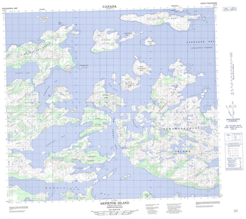
014C03 Akpiktok Island Canada topo map, 1:50,000 scale
014C03 Akpiktok Island NRCAN topographic map.
Includes UTM and GPS geographic coordinates (latitude and longitude). This 50k scale map is suitable for hiking, camping, and exploring, or you could frame it as a wall map.
Printed on-demand using high resolution, on heavy weight and acid free paper, or as an upgrade on a variety of synthetic materials.
Topos available on paper, Waterproof, Poly, or Tyvek. Usually shipping rolled, unless combined with other folded maps in one order.
- Product Number: NRCAN-014C03
- Parent Topo: TOPO-014C
- Map ID also known as: 014C03, 14C3, 14C03
- Unfolded Size: Approximately 26" high by 36" wide
- Weight (paper map): ca. 55 grams
- Map Type: POD NRCAN Topographic Map
- Map Scale: 1:50,000
- Geographical region: Newfoundland and Labrador, Canada
Neighboring Maps:
All neighboring Canadian topo maps are available for sale online at 1:50,000 scale.
Purchase the smaller scale map covering this area: Topo-014C
Spatial coverage:
Topo map sheet 014C03 Akpiktok Island covers the following places:
- Boat Harbour - House Harbour - Jackos Cove - Kangekluktanna Bay - Kayutak Bay - Merrifield Bay - Nothing Bay - Nuvudluktok Bay - Takpanayok Bay - Tasiuyak Bay - Uivasuk Cove - Zoar Bay - Cape Little - Tikigatsiak Peninsula - Uibarsuk Peninsula - Uibyak Peninsula - Inside Tickle - Perrett Tickle - Shoal Tickle - Tom Gears Run - Aklaktalik Island - Akpiktok Island - Akpiktok Kitta Island - Annaksarkhat Islands - Bear Island - Big Island - Gibraltar Island - Iglosiatik Island - Napaktotok Island - North Tunungayukaluk Island - Northnukoluk Island - Nuasurnakuluk Island - Okpatik Island - Pigeon Islet - Seal Island - Seniartlit Islands - South Tunungayukaluk Island - Tuktuinak Island - Tunungayualok Island - Uibarsuk Island - Tasialuk Lake - Labrador Sea - Mer du Labrador - Zoar


