
013J16E Webeck Harbour Canada topo map, 1:50,000 scale
013J16E Webeck Harbour NRCAN topographic map.
Includes UTM and GPS geographic coordinates (latitude and longitude). This 50k scale map is suitable for hiking, camping, and exploring, or you could frame it as a wall map.
Printed on-demand using high resolution, on heavy weight and acid free paper, or as an upgrade on a variety of synthetic materials.
Topos available on paper, Waterproof, Poly, or Tyvek. Usually shipping rolled, unless combined with other folded maps in one order.
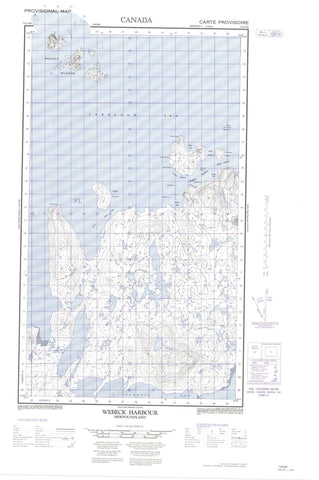
- Halfsheet: This map was designed as a half sheet of NRCAN-013J16, and it is the Eastern half. Find the western half sheet here.
- Product Number: NRCAN-013J16E
- Parent Topo: TOPO-013J
- Map ID also known as: 013J16, 13J16
- Unfolded Size: Approximately 26" high by 36" wide
- Weight (paper map): ca. 55 grams
- Map Type: POD NRCAN Topographic Map
- Map Scale: 1:50,000
- Geographical region: Newfoundland and Labrador, Canada
Neighboring Maps:
All neighboring Canadian topo maps are available for sale online at 1:50,000 scale.
Purchase the smaller scale map covering this area: Topo-013J
Spatial coverage:
Topo map sheet 013J16E Webeck Harbour covers the following places:
- False Bay - Grave Bay - Jeanette Bay - Jigger Bight - Kettle Bay - Mad Cat Cove - Rocky Bay - Sloop Cove - Tilt Cove - Tuchialic Bay - Tukialik Bay - Webeck Harbour - Wreck Bay - Big Head - Deus Cape - North Head - Shoal Point - Smooth Point - Tuchialic Point - Wolf Head - Clinker Channel - Jigger Tickle - Main Channel - Western Channel - Bear Island - Cuthbert Island - Double Island - Harbour Island - Jigger Island - Morrison Island - Northern Island - Ragged Islands - Rogers Island - Smoky Islands - Webeck Island - Tessuialluk Lake - Tilt Cove Pond - Big Heads - Green Hill - Pyramid Hill - Labrador Sea - Mer du Labrador - Harbour Rocks - The Sisters - Lucyville


