
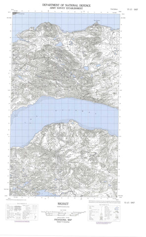
013J01E Rigolet Canada topo map, 1:50,000 scale
013J01E Rigolet NRCAN topographic map.
Includes UTM and GPS geographic coordinates (latitude and longitude). This 50k scale map is suitable for hiking, camping, and exploring, or you could frame it as a wall map.
Printed on-demand using high resolution, on heavy weight and acid free paper, or as an upgrade on a variety of synthetic materials.
Topos available on paper, Waterproof, Poly, or Tyvek. Usually shipping rolled, unless combined with other folded maps in one order.
- Halfsheet: This map was designed as a half sheet of NRCAN-013J01, and it is the Eastern half. Find the western half sheet here.
- Product Number: NRCAN-013J01E
- Parent Topo: TOPO-013J
- Map ID also known as: 013J01, 13J1, 13J01
- Unfolded Size: Approximately 26" high by 36" wide
- Weight (paper map): ca. 55 grams
- Map Type: POD NRCAN Topographic Map
- Map Scale: 1:50,000
- Geographical region: Newfoundland and Labrador, Canada
Neighboring Maps:
All neighboring Canadian topo maps are available for sale online at 1:50,000 scale.
Purchase the smaller scale map covering this area: Topo-013J
Spatial coverage:
Topo map sheet 013J01E Rigolet covers the following places:
- Burned Wood Cove - Burntwood Cove - Collinghams Cove - Coopers Cove - Double Mer - Ely Cove - Fly Cove - Goudies Cove - Goudies Cove - Grassy Cove - Groswater Bay - Hamilton Inlet - Little Harbour - Long Harbour - Mad Dog Cove - Mullins Cove - Nats Discovery - Old House Cove - Pease Cove - Ploctors Cove - Rigolet Cove - Summer Cove - Tea Pond - The Backway - Turner's Bight - Whale Boat Cove - Back Bay Cape - Burned Woods - Double Mer - East Caracajou Point - Grants Head - Grassy Point - Gunnan Point - Halfway Head - Hart Head - Holme Point - Hunniuck - Indian Point - Jewel Point - John Goudies Long Point - Johns Point - Johns Point - Jordans Point - Juniper Point - Lester Point - Little Head - Longue Point - Mountain Cat Point - Mullins Head - Nats Discovery Point - Palliser Point - Peters Point - Procters Head - Rigolet Point - Strathcona Point - The Flat Point - The Flat Pond - Turner's Head - Whale Boat Point - Whittles Point - Cul-de-Sac - Pike (Back) Run - The Narrows - Broomfield Island - Chance Island - Henrietta Island - Hunniuck Island - Sheep Island - Smith Island - Lake Melville - Southern Pond - Big Hill - Gnat Mountain - Horse Chops Hill - Sharp Hill - Sunday Hill - Berry Brook - Cunninghams Brook - Groves Brook - McKenzies Brook - Minks Brooks - Nanook Brook - Rattling Brook - Lower Seal Rocks - Man of War Rock - Rhodes Rocks - Sand Banks - Upper Seal Rocks - Turner's Bight - Rigolet


