
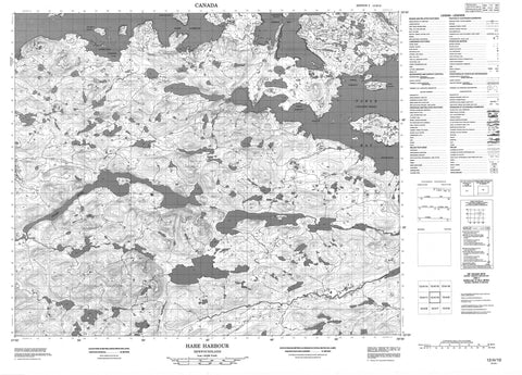
013H10 Hare Harbour Canada topo map, 1:50,000 scale
013H10 Hare Harbour NRCAN topographic map.
Includes UTM and GPS geographic coordinates (latitude and longitude). This 50k scale map is suitable for hiking, camping, and exploring, or you could frame it as a wall map.
Printed on-demand using high resolution, on heavy weight and acid free paper, or as an upgrade on a variety of synthetic materials.
Topos available on paper, Waterproof, Poly, or Tyvek. Usually shipping rolled, unless combined with other folded maps in one order.
- Product Number: NRCAN-013H10
- Parent Topo: TOPO-013H
- Map ID also known as: 013H10, 13H10
- Unfolded Size: Approximately 26" high by 36" wide
- Weight (paper map): ca. 55 grams
- Map Type: POD NRCAN Topographic Map
- Map Scale: 1:50,000
- Geographical region: Newfoundland and Labrador, Canada
Neighboring Maps:
All neighboring Canadian topo maps are available for sale online at 1:50,000 scale.
Purchase the smaller scale map covering this area: Topo-013H
Spatial coverage:
Topo map sheet 013H10 Hare Harbour covers the following places:
- Backguard Bay - Big Bight - Big Bight - Big Cove - Big Paddys Cove - Black Duck Cove - Blackguard Bay - Burn Point Cove - Cellar Point Cove - Crab Harbour - Goose Cove - Hare Harbour - Indian Cove - Isthmus Bay - Lamverts Path End - Larks Harbour - Little Paddys Cove - Little Seal Cove - Lower Haunted Bight - Luddies Cove - Luggs Cove - Marias Cove - North Harbour - Perrys Cove - Pigeon Cove - Sams Cove - Skate Back Pond - Skiff Cove - South Road - Southeast Cove - Stag Cove - Star Bight - Suttons Cove - Table Bay - Tiky Tie Hook - Venison Cove - Birchy Point - Black Head - Burn Point - Cat Head - Cellar Point - Crab Head - Fox Point - Grog Point - Hackets Head - Hanrahan Point - Indian Head - Little Crab Head - Lower Crab Head - Luggs Cove Point - Lugs Point - Marias Point - Nakookies Head - Penniuks Point - Penuks Point - Pigeon Head - Sams Point - Stag Point - Suglo Point - Suttons Point - Toomashies Lead - Toomashies Point - Upper Crab Head - Venison Head - Bull Gut - Black Cliffs - Little Black Cliffs - Black Cliffs Island - Cartwright Island - Crab Island - Deadmans Island - Duck Island - East Hare Island - Fillbelly Island - Grassy Island - Hare Islands - Huntingdon Island - Ledge Island - Little Duck Island - Little Ledge Island - Little Star Island - Star Island - Willow Beds - Woody Island - Big Beaver Pond - Birchy Hill Pond - Burdettes Brook Second Pond - Country Cat Pond - Crooked Pond - Freshwater Pond - Fridays Pond - Goose Cove Pond - Goose Pond - Grassy Rubbin Pond - Jackies Pond - John Davis Pond - John Davis Steady - Larks Harbour Pond - Little Beaver Pond - Little Pond - Morris Pond - Muddy Bay Pond - Muskrat Pond - Round Pond - Table Bay Pond - White Hills Pond - Andrew Hill - Big Hill - Birchy Hill - Black Head - Little Hill - Scout Hill - Stag Hill - Stag Hill - Sundown Hill - Table Hill - The Big Hill - White Hills - Big Rattle - Birdets Brook - Burdettes Brook - Cellar Point Brook - Country Cat Brook - Doodlin Brook - Dykes River - Fridays Brook - Goose Cove Brook - Jackies Brook - Larks Harbour Brook - Luddies Brook - Muddy Bay Brook - Otter Brook - Round Pond Brook - Scout Brook - Stag Brook - Table Bay Brook - White Hills Brook - White Hills Brook - Labrador Sea - Mer du Labrador - Flat Rocks - Mad Moll - Whale Rock - Hare Harbour - Table Bay - Cellar Droke - Murderin Gulch - Goose Cove Marshes - Inside Marsh - Outside Marsh - Scout Brook Marshes


