
013G15W Neveisik Island Canada topo map, 1:50,000 scale
013G15W Neveisik Island NRCAN topographic map.
Includes UTM and GPS geographic coordinates (latitude and longitude). This 50k scale map is suitable for hiking, camping, and exploring, or you could frame it as a wall map.
Printed on-demand using high resolution, on heavy weight and acid free paper, or as an upgrade on a variety of synthetic materials.
Topos available on paper, Waterproof, Poly, or Tyvek. Usually shipping rolled, unless combined with other folded maps in one order.
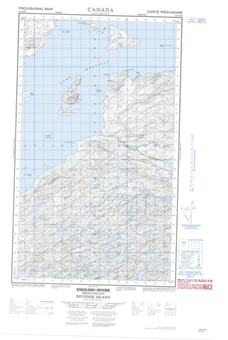
- Halfsheet: This map was designed as a half sheet of NRCAN-013G15, and it is the Western half. Find the eastern half sheet here.
- Product Number: NRCAN-013G15W
- Parent Topo: TOPO-013G
- Map ID also known as: 013G15, 13G15
- Unfolded Size: Approximately 26" high by 36" wide
- Weight (paper map): ca. 55 grams
- Map Type: POD NRCAN Topographic Map
- Map Scale: 1:50,000
- Geographical region: Newfoundland and Labrador, Canada
Neighboring Maps:
All neighboring Canadian topo maps are available for sale online at 1:50,000 scale.
Purchase the smaller scale map covering this area: Topo-013G
Spatial coverage:
Topo map sheet 013G15W Neveisik Island covers the following places:
- Barrel Cove - Hamilton Inlet - Lower Sandy Cove - Pelter Cove - Port Disappointment - Round Harbour - Sandy Cove - Swallow Harbour - Harbour Grace - Bellas Point - Big Point - Frenchman Point - High Point - Old House Point - Reed Point - Sandy Cove Head - Smokey Point - Trout Point - Little Shoal Tickle - Shoal Tickle - St. John's Tickle - Red Cliff - Acadia Islands - Andy Island - Bear Island - Green Island - Gull Island - HainesIsland - Handy Island - Indian Island - Island Rock - Neveisik Island - Outer Barred Islands - Rocky Islands - St. John Island - Trout Island - Clear Pond - Deer Hill Pond - Deer Pond - Lake Melville - Long Steady - Otter Brook Pond - Pancake Pond - Sandy Cove Pond - Shiwaks Pond - Stag Pond - Upper Sandy Cove Pond - Mealy Mountains - Marks Rapids - Shellbird Rapids - Beaver Brook - English River - Frenchmans Brook - Grants Brook - Lochan River - Peter Lewis Brook - Peter Lewis Brook - Sandy Cove Brook - Trout Cove Brook - Blue Seal Shoal - Lareto Shoal - Antler Cirque - Crosswater Marshes


