
012P13 Ruisseau Chanion Canada topo map, 1:50,000 scale
012P13 Ruisseau Chanion NRCAN topographic map.
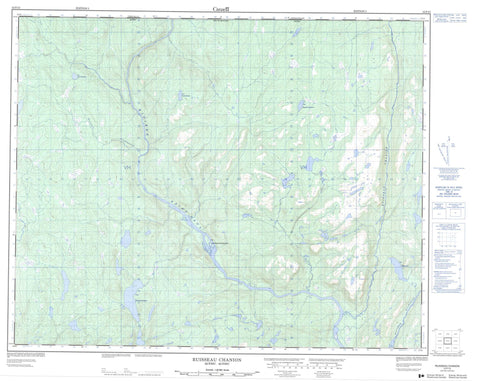
Includes UTM and GPS geographic coordinates (latitude and longitude). This 50k scale map is suitable for hiking, camping, and exploring, or you could frame it as a wall map.
Printed on-demand using high resolution, on heavy weight and acid free paper, or as an upgrade on a variety of synthetic materials.
Topos available on paper, Waterproof, Poly, or Tyvek. Usually shipping rolled, unless combined with other folded maps in one order.
- Product Number: NRCAN-012P13
- Parent Topo: TOPO-012P
- Map ID also known as: 012P13, 12P13
- Unfolded Size: Approximately 26" high by 36" wide
- Weight (paper map): ca. 55 grams
- Map Type: POD NRCAN Topographic Map
- Map Scale: 1:50,000
- Geographical region: Newfoundland and Labrador, Canada
Neighboring Maps:
All neighboring Canadian topo maps are available for sale online at 1:50,000 scale.
Purchase the smaller scale map covering this area: Topo-012P
Spatial coverage:
Topo map sheet 012P13 Ruisseau Chanion covers the following places:
- Ruisseau Coal Oil - Pointe Aibon - Pointe Burnt Trap - Pointe Carcajou - Pointe Diner - Pointe Putting - Pointe White Wood - Île Bear - Île Seal - Îles Kaministukueuetshuahk - Îlot Fly - Lac Beaver - Lac Bob - Lac Candy - Lac Chapeau - Lac Hepukunapeu - Lac Hikahtnu - Lac John-Baptiste - Lac Jos - Lac Kapukuniahkuet - Lac Katnukamat - Lac Kuekuatsheu - Lacs à la Tente - Mont Pope Head - Mont Porc-Épic - Le Petit Rapide - Les Grands Rapides - Rivière Bujeault - Rivière des Esquimaux - Rivière Perdrix - Rivière Saint-Paul - Ruisseau Beaver House - Ruisseau Black-Charles - Ruisseau Bob - Ruisseau Carcajou - Ruisseau Chanion - Ruisseau Charlie-Mark - Ruisseau Deer - Ruisseau Gulch - Ruisseau Jos - Ruisseau Juniper - Ruisseau Kapanachi - Ruisseau Kuekuatsheu - Ruisseau Lucky - Ruisseau Phil's Cabin - Ruisseau Rocky - Ruisseau Seven Islands - Ruisseau Sleigh - Ruisseau Slip - Ruisseau Toe Nail - Ruisseau Uahatu - Ruisseau William - Fosse Big Dick - Fosse Big-John - Fosse Bob - Fosse Chandler - Fosse Ches - Fosse Chuck - Fosse Claudette - Fosse Cornerbrook - Fosse du Ruisseau Bob - Fosse Ed - Fosse Gimpy - Fosse Home - Fosse Jacquette - Fosse Jon - Fosse Kapanachi - Fosse Lucky - Fosse Old-Will - Portage du Petit-Rapide - Deer Ground - George-Nother Ground - Kaminuaskuiast - Lucky Brook Ground - The Gib


