
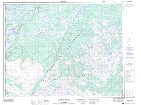
012I15 Castors River Canada topo map, 1:50,000 scale
012I15 Castors River NRCAN topographic map.
Includes UTM and GPS geographic coordinates (latitude and longitude). This 50k scale map is suitable for hiking, camping, and exploring, or you could frame it as a wall map.
Printed on-demand using high resolution, on heavy weight and acid free paper, or as an upgrade on a variety of synthetic materials.
Topos available on paper, Waterproof, Poly, or Tyvek. Usually shipping rolled, unless combined with other folded maps in one order.
- Product Number: NRCAN-012I15
- Parent Topo: TOPO-012I
- Map ID also known as: 012I15, 12I15
- Unfolded Size: Approximately 26" high by 36" wide
- Weight (paper map): ca. 55 grams
- Map Type: POD NRCAN Topographic Map
- Map Scale: 1:50,000
- Geographical region: Newfoundland and Labrador, Canada
Neighboring Maps:
All neighboring Canadian topo maps are available for sale online at 1:50,000 scale.
Purchase the smaller scale map covering this area: Topo-012I
Spatial coverage:
Topo map sheet 012I15 Castors River covers the following places:
- Bartletts Harbour - Caribou Cove - Castors Harbour - Golfe du Saint-Laurent - Gulf of St. Lawrence - Mosquito Cove - South Cove - Southeast Cove - Squid Cove - St. John Bay - Bear Cove Head - Castor Point - Northern Peninsula - Yellow Point - Castor Point Island - Airplane Pond - Big Feeder Pond - Billys Pond - Bluey on Big East - Coffee Pond - Coombs Pond - Doctors Pond - Double Pond - Dunn Lake - East Castor Pond - Flat Steady - Fox Pond - George Coombs Steady - Island Steady - Jacobs Pond - Leg Pond - Loon Pond - Middle Point Pond - Papoose Pond - Pittmans Pond - Raft Pond - Scaffold Pond - Seven Island Pond - Shellbird Pond - Sister Pond - Snowy Lake - Tilt Pond - Trout Pond - Tuckers Steady - Two Mile Pond - Woodpecker Pond - Woods Pond - Flecks Nuddick - Highlands of St. John - Leanders Hill - Little Sugar Loaf - Mun Dunn - North Summit - Three Mile Lake Provincial Park - Beaver Brook - Bill Toms Feeder - Castors River - Cloud River - Doctors Brook - East River - Greta Brook - Middle Gulch Brook - Middle Gulch Brook North Branch - Salmon River - The Bar - Bartletts Harbour - Castor River North - Castor River South - Castors River - Castors River North


