
012I10 Torrent River Canada topo map, 1:50,000 scale
012I10 Torrent River NRCAN topographic map.
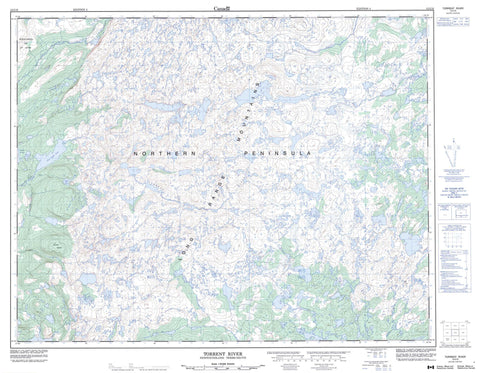
Includes UTM and GPS geographic coordinates (latitude and longitude). This 50k scale map is suitable for hiking, camping, and exploring, or you could frame it as a wall map.
Printed on-demand using high resolution, on heavy weight and acid free paper, or as an upgrade on a variety of synthetic materials.
Topos available on paper, Waterproof, Poly, or Tyvek. Usually shipping rolled, unless combined with other folded maps in one order.
- Product Number: NRCAN-012I10
- Parent Topo: TOPO-012I
- Map ID also known as: 012I10, 12I10
- Unfolded Size: Approximately 26" high by 36" wide
- Weight (paper map): ca. 55 grams
- Map Type: POD NRCAN Topographic Map
- Map Scale: 1:50,000
- Geographical region: Newfoundland and Labrador, Canada
Neighboring Maps:
All neighboring Canadian topo maps are available for sale online at 1:50,000 scale.
Purchase the smaller scale map covering this area: Topo-012I
Spatial coverage:
Topo map sheet 012I10 Torrent River covers the following places:
- The West Bay - Baines Head - Gravel Head - Northern Peninsula - Green Diamond Skirt - North East Woods - Pelleys Skirt - The Sail - Air Force Pond - Basin Pond - Black Stag Pond - Brents Pond - Candy Pond - Caterpillar Pond - Chambers Pond - Everetts Pond - Five Hills Pond - Five Mile Pond - Flat Hill Pond - Harrys Pond - Indian Steady - Island Pond - Lady Worcester Pond - Long Pond - Lucky Strike Pond - Mountain Pond - Muddy Springs - Otter Pond - Pelleys Skirt Pond - Pikes Feeder Pond - Pikeys Feeder - Rays Pond - Red Rod Feeder - Red Sea Pond - Rocky Stint - Roddickton Lakes - Rumbolts Pond - Slug Pond - Trokes Pond - Whit Pilgrims Pond - Wilsons Pond - Woody Hill Pond - American Man - Devils Lookout - Five Mile Hill - Highlands of St. John - Long Range Mountains - Lucky Strike - Mount Hogan - Suttons Roost - The Five Hills - The Sisters - Woody Hill - Cloud River - East River - Lady Worcester Brook - Lucky Strike Brook - Middle Gulch - Soufflets River - Torrent River - Killdevil Gulch - The Gap - Lady Worcester Barrens - Wolf Barren


