
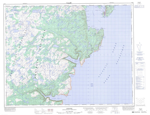
012I09 Englee Canada topo map, 1:50,000 scale
012I09 Englee NRCAN topographic map.
Includes UTM and GPS geographic coordinates (latitude and longitude). This 50k scale map is suitable for hiking, camping, and exploring, or you could frame it as a wall map.
Printed on-demand using high resolution, on heavy weight and acid free paper, or as an upgrade on a variety of synthetic materials.
Topos available on paper, Waterproof, Poly, or Tyvek. Usually shipping rolled, unless combined with other folded maps in one order.
- Product Number: NRCAN-012I09
- Parent Topo: TOPO-012I
- Map ID also known as: 012I09, 12I9, 12I09
- Unfolded Size: Approximately 26" high by 36" wide
- Weight (paper map): ca. 55 grams
- Map Type: POD NRCAN Topographic Map
- Map Scale: 1:50,000
- Geographical region: Newfoundland and Labrador, Canada
Neighboring Maps:
All neighboring Canadian topo maps are available for sale online at 1:50,000 scale.
Purchase the smaller scale map covering this area: Topo-012I
Spatial coverage:
Topo map sheet 012I09 Englee covers the following places:
- Aiguillette's (Englee) Harbour - Barbers Cove - Big Cove - Boat Cove - Canada Bay - Canaries Harbour - Cape Tug Cove - Cat Cove - Cat Cove Bight - Eastern Arm - Englee Harbour - Fardys Cove - Fourché Harbour - Green Cove - Grevigneux Harbour - Handy Harbour - Hauling Cove - Hooping Harbour - Landing Cove - Leather Shoe Pond Cove - Little Canada Harbour - Little Hooping Harbour - Little Hooping Harbour - Northeast Cove - Northern Arm - Northern Arm - Seal Cove - Silver Cove - Sugarloaf Cove - Torrent Cove - Twillingate Cove - Wild Cove - Bide Head - Big Burnt Head - Big Cove Head - Big Head - Burnt Point - Burnt Point - Canada Head - Canada White Point - Cape Daumalen - Cape Tasse - Cape Tasse - Cape Tug - Chant du Merle - Duckbill Point - Eastern Head - Flagstaff Point - Fourché Point - Granite Point - Green Head - Grevigneux Point - Handy Harbour Head - Hells Mouth Point - Lands End - Little Burnt Head - Northern Peninsula - Parsons Head - Squally Point - Stony Point - Twillingate Head - Twillingate Head - White Point - Wild Cove Point - Mustard Cliff - Sugar Loaf - Black Woods - Blue Skirt - Charlies Skirt - Georges Woods - Halfway Woods - Barred Island - Englee Island - Flat Island - Gouffre Island - Green Island - White Island - Bateau Cove Pond - Bear Pond - Beaver House Pond - Big Bottom Ponds - Big Cove Pond - Big Pond - Biggins Pond - Bight Pond - Breens Pond - Charlies Pond - Chimney Waters - Cozy Pond - Doris Pond - Duck Pond - Dung Hill Pond - Fox Pond - Freds Pond - Georges Lakes - Gillards Pond - Gords Pond - Half Hour Pond - Harriets Pond - Hells Mouth Pond - Hencock Pond - Island Cove Pond - Island Pond - Island Pond - Lower Cat Cove Pond - Lower Pond - Lumpus Pond - Mistake Pond - Ocean Pond - One Tree Pond - Pay Pond - Run By Guess - Saw Pit Pond - Shoe Pond - Small Seal Cove Pond - Twillingate Pond - Upper Cat Cove Pond - Upper Pond - Venison Pond - Wild Cove Pond - Cape Goboso Summit - Duck Ridge - Dung Hill - Eastern Hill - Fox Ridge - Joyces Lookout - Liges Hill - Lion Hill - Long Range Mountains - Northern Hay Peak - Pebble Hill - Southern Hay Peak - Toms Knob - Western Hay Peak - Whalesback - Hencock Brook - Henry Cassells Brook - Henry Comptons Brook - Hooping Harbour Brook - Aiguillettes Rock - Clark Rock - Cod Rock - Hermit Rock - Herring Shoal - Tasse Shoal - Turtle Rocks - Watchers - Wolf Shoal - Englee - Canada Harbour - Hooping Harbour - Wild Cove - Williamsport


