
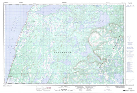
012I06 Bellburns Canada topo map, 1:50,000 scale
012I06 Bellburns NRCAN topographic map.
Includes UTM and GPS geographic coordinates (latitude and longitude). This 50k scale map is suitable for hiking, camping, and exploring, or you could frame it as a wall map.
Printed on-demand using high resolution, on heavy weight and acid free paper, or as an upgrade on a variety of synthetic materials.
Topos available on paper, Waterproof, Poly, or Tyvek. Usually shipping rolled, unless combined with other folded maps in one order.
- Product Number: NRCAN-012I06
- Parent Topo: TOPO-012I
- Map ID also known as: 012I06, 12I6, 12I06
- Unfolded Size: Approximately 26" high by 36" wide
- Weight (paper map): ca. 55 grams
- Map Type: POD NRCAN Topographic Map
- Map Scale: 1:50,000
- Geographical region: Newfoundland and Labrador, Canada
Neighboring Maps:
All neighboring Canadian topo maps are available for sale online at 1:50,000 scale.
Purchase the smaller scale map covering this area: Topo-012I
Spatial coverage:
Topo map sheet 012I06 Bellburns covers the following places:
- Bateau Cove - Golfe du Saint-Laurent - Gulf of St. Lawrence - La Fontaine Point - Northern Peninsula - Angle Pond - Bank Pond - Basin Pond - Bellburns Pond - Big Feeder Pond - Big Marsh Pond - Black Duck Pond - Bog Pond - Braggs Pond - Brians Leads - Brians Pond - Burn Marsh Pond - Clay Water - Cobbles Pond - Dry Hole - Dry Pond - East Clay Water Pond - Eastern Blue Pond - Eastern Main Part Steady - Flat Pond - Flat Pond - Forked Feeder Pond - Frenchman Pond - Georges Pond - Grassy Pond - Gull Pond - Harrisons Pond - Harrys Pond - High Pond - Horseshoe - Inner Pond - Inside Two Sisters - Island Pond - Joes Pond - Katesis Feeder Pond - Katesis Pond - Lake Michel - Lawyers Pond - Little Northeast Pond - Long Hole - Long Marsh Pond - Long Pond - Long Pond - Main Part Pond - Middle Tilt Pond - Muddy Pond - Northeast Pond - Otter Pond - Otter Pond - Outside Two Sisters - Pateys Long Pond - Pie Duck Pond - Pittmans Steady - River of Ponds Lake - Rocky Pond - Sandy Cove Tilt - Silver Marsh Pond - Sinnicks Long Pond - Smarts Pond - Spring Tilt - Tilt Pond - Upper Cobbles Pond - West Clay Water Pond - Western Blue Pond - Blue Mountain - Long Range Mountains - Table Point Ecological Reserve - Cobbles Flats - Main Part Brook - Rushie Brook - Red Cleft - Bateau Barrens - Brians Bogs - Burn Marsh - Eastern Pond Marsh - Hish Marsh - Long Marsh - North Marsh - Rocky Pond Marshes - Silver Marsh - Tilt Marsh


