
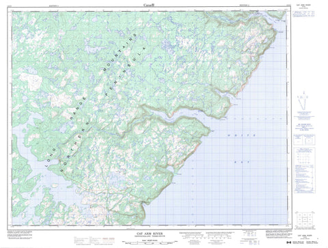
012I02 Cat Arm River Canada topo map, 1:50,000 scale
012I02 Cat Arm River NRCAN topographic map.
Includes UTM and GPS geographic coordinates (latitude and longitude). This 50k scale map is suitable for hiking, camping, and exploring, or you could frame it as a wall map.
Printed on-demand using high resolution, on heavy weight and acid free paper, or as an upgrade on a variety of synthetic materials.
Topos available on paper, Waterproof, Poly, or Tyvek. Usually shipping rolled, unless combined with other folded maps in one order.
- Product Number: NRCAN-012I02
- Parent Topo: TOPO-012I
- Map ID also known as: 012I02, 12I2, 12I02
- Unfolded Size: Approximately 26" high by 36" wide
- Weight (paper map): ca. 55 grams
- Map Type: POD NRCAN Topographic Map
- Map Scale: 1:50,000
- Geographical region: Newfoundland and Labrador, Canada
Neighboring Maps:
All neighboring Canadian topo maps are available for sale online at 1:50,000 scale.
Purchase the smaller scale map covering this area: Topo-012I
Spatial coverage:
Topo map sheet 012I02 Cat Arm River covers the following places:
- Camp Cove - Deep Cove - Devil Cove - Great Cat Arm - Little Cat Arm - Little Harbour Deep - Outer Cove - Pumbly Cove - The Bottom - White Bay - Wild Beach - Big Head - Birchy Head - Eastern Head - Grandfather Head - Little Harbour Deep Head - Net Point - Northern Peninsula - Sandy Point - Shoal Point - Stump Point - Wedge Point - Western Head - White Point - Long Range Mountains - Cat Arm River - Little Harbour Deep River - Grandfather Rock - The Middle Ground - Little Harbour Deep


