
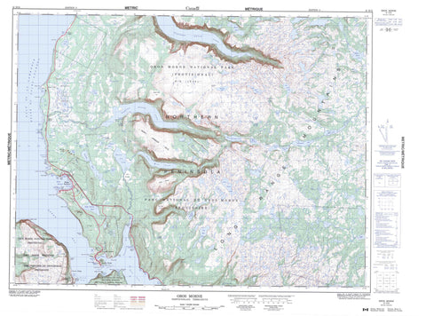
012H12 Gros Morne Canada topo map, 1:50,000 scale
012H12 Gros Morne NRCAN topographic map.
Includes UTM and GPS geographic coordinates (latitude and longitude). This 50k scale map is suitable for hiking, camping, and exploring, or you could frame it as a wall map.
Printed on-demand using high resolution, on heavy weight and acid free paper, or as an upgrade on a variety of synthetic materials.
Topos available on paper, Waterproof, Poly, or Tyvek. Usually shipping rolled, unless combined with other folded maps in one order.
- Product Number: NRCAN-012H12
- Parent Topo: TOPO-012H
- Map ID also known as: 012H12, 12H12
- Unfolded Size: Approximately 26" high by 36" wide
- Weight (paper map): ca. 55 grams
- Map Type: POD NRCAN Topographic Map
- Map Scale: 1:50,000
- Geographical region: Newfoundland and Labrador, Canada
Neighboring Maps:
All neighboring Canadian topo maps are available for sale online at 1:50,000 scale.
Purchase the smaller scale map covering this area: Topo-012H
Spatial coverage:
Topo map sheet 012H12 Gros Morne covers the following places:
- Bailers Cove - Beachy Cove - Bear Cove - Berry Head Cove - Bonne Bay - Bread and Butter Cove - Bread and Butter Cove - Crolly Cove - Deckers Cove - Deer Arm - Eastern Arm - Gadds Harbour - Golfe du Saint-Laurent - Green Cove - Gulf of St. Lawrence - Lobster Cove - Mill Cove - Mill Cove - Neddy Harbour - Norris Cove - Rocky Harbour - Rocky Harbour Cove - Sally's Cove - Sandy Cove - Seal Cove - Shoal Cove - Shoal Cove - Shoal Cove - Stores Cove - The Bottom - Wild Cove - Woody Cove - Beachy Point - Berry Head - Burnt Point - Eastern Head - Gadds Point - Green Point - Green Point - Gun Point - Homers Point - Lobster Cove Head - Long Point - Much's Point - Norris Point - Paynes Head - Pond Point - Reid Point - Reid Point - Rocky Hills - Salmon Point - Sandy Head - Shoal Point - Shoal Point - Storehouse Point - Wigwam Point - Wild Cove Head - Woody Point - Yellow Point - The Tickle - Crow Cliff - Shag Cliff - Two Little Cliffs - Crow Gulch Falls - High Falls - Birch Rine Woods - Andrews Pond - Angle Pond - Angus Lake - Bakers Brook Inner Pond - Bakers Brook Middle Pond - Bakers Brook Pond - Barachois Pond - Beaver Pond - Beaver Ponds - Bens Gulch Pond - Berry Head Pond - Big Island Pond - Big Island Pond - Big Island Pond Steadies - Big Pond - Big Stag Pond - Birchy Pond - Black Cliff Pond - Black Cliff Pond - Black Duck Ponds - Blakes Pond - Boggan Pond - Bottle Pond - Bowdens Pond - Bull Pond - Bullet Pond - Candlestick Pond - Candlestick Pond - Carken Pond - Chainlings Pond - Crown Hill Pond - Cullihalls Pond - Deep Pond - Deer Pond - Eastern Arm Pond - First Pond - Five Island Pond - Flagstaff Pond - Fourth Pond - Fourth Pond - Gilley Pond - Goose Hole - Grassey Brook Pond - Grassy Brook Pond - Green Island Pond - Gull Pond - Gull Pond - Gull Pond - Halfmoon Pond - Hardings Pond - Hardings Pond - Hummock Pond - Island Pond - Jacks Pond - Jerrys Pond - Jesse Abes Pond - Little Island Pond - Little Pond - Long Pond - Long Pond - Long Pond - Lou Pond - Lower Gap Pond - Lower Pond - Marks Pond - Middle Camp Pond - Middle Camp Pond - Molten Pond - Muddy Pond - Mudhole Pond - Narrow Pond - Narrow Pond - Narrows Pond - Neddy Harbour Pond - Northcott Waters - Notch Pond - Pie Duck Pond - Pilgrim Pond - Raft Pond - Rock Cave Pond - Rocky Harbour Little Pond - Rocky Harbour Pond - Rushy Pond - Sandy Pond - Second Pond - Spike Knee Pond - Spirity Pond - Stag Pond - Stag Pond - Stores Cove Pond - Ten Mile Pond - Third Pond - Tilt Pond - Trout Pond - Two Mile Pond - Two Ponds - Two Rock Pond - Western Brook Pond - Woody Pond - Woody Pond - Berry Hill - Big Hill - Big Level - Big Lookout - Blue Rocks - Blue Rocks (Ridge) - Green Point Hill - Gros Morne - Long Range Mountains - Lookout Hills - Neddy Hill - Old Crow - Puncheon Rock - Rocky Harbour Hills - Sams Rock - Sams Rock (Ridge) - Sloping Rock - The Big Level - Gros Morne National Park of Canada - Gros Morne National Park World Heritage Site - Parc national du Canada du Gros-Morne - Site du patrimoine mondial du Parc national du Gros-Morne - Bakers Brook - Bottom Creek - Brakes Brook - Corner Brook - Crow Gulch - Deer Brook - Eastern Arm Brook - Eel Brook - Ferry Gulch - Grassy Brook - Little Brook - Mackenzies Mill Brook - Mill Brook - Mitchells Brook - Narrows Pond River - Rattling Brook - Rocky Barachois Brook - Sparkes Brook - Sparkes Gulch - Upper Humber River - Gun Point Shoals - Lower Gull Rock - Norris Point Shoal - Two Gull Rocks - Two Gull Rocks - Upper Gull Rock - Yellow Rocks - Norris Point - Rocky Harbour - Sally's Cove - Woody Point - Bakers Brook - Bear Cove - Bonne Bay - Curzon - Curzon Village - Gadds Harbour - Green Point - Lobster Cove - Neddy Harbour - Norris Point - Rocky Harbour - Wild Cove - Woody Cove - Bens Gulch - Deer Gulch - Glander Gulch - Halfway Gulch - Ten Mile Gulch - Woody Gulch - Apse Barrens - Bakers Brook Marsh - Berry Head Marsh - Bobs Barrens - Middle Barrens - Shears Barrens


