
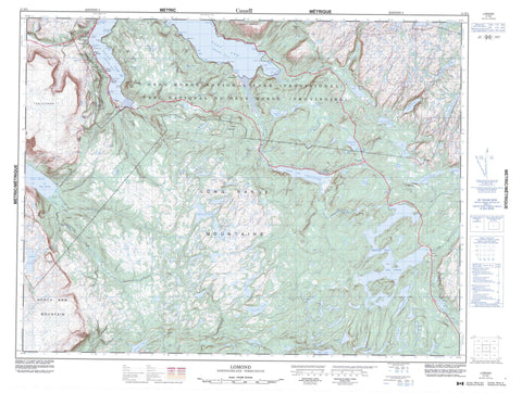
012H05 Lomond Canada topo map, 1:50,000 scale
012H05 Lomond NRCAN topographic map.
Includes UTM and GPS geographic coordinates (latitude and longitude). This 50k scale map is suitable for hiking, camping, and exploring, or you could frame it as a wall map.
Printed on-demand using high resolution, on heavy weight and acid free paper, or as an upgrade on a variety of synthetic materials.
Topos available on paper, Waterproof, Poly, or Tyvek. Usually shipping rolled, unless combined with other folded maps in one order.
- Product Number: NRCAN-012H05
- Parent Topo: TOPO-012H
- Map ID also known as: 012H05, 12H5, 12H05
- Unfolded Size: Approximately 26" high by 36" wide
- Weight (paper map): ca. 55 grams
- Map Type: POD NRCAN Topographic Map
- Map Scale: 1:50,000
- Geographical region: Newfoundland and Labrador, Canada
Neighboring Maps:
All neighboring Canadian topo maps are available for sale online at 1:50,000 scale.
Purchase the smaller scale map covering this area: Topo-012H
Spatial coverage:
Topo map sheet 012H05 Lomond covers the following places:
- Burtons Cove - Deep Water Cove - Dicks Cove - East Arm - Hell Cove - Howletts Cove - John Whites Cove - Lomond Cove - Long Bight - Long Bight Cove - Lord & Lady Cove - Norris Cove - Paynes Cove - Robinsons Cove - Rocky Cove - Seal Cove - South Arm - South East Arm - St. Josephs Cove - Tuckers Brook - Woody Point Anchorage - Baileys Point - Beachy Point - Birchy Head - Dicks Point - Entrance Point - Foul Point - Gray Point - Paynes Point - South Head - Tuckers Head - Youngs Point - Black Cliff - Halfway Cliff - Angle Pond - Bad Weather Pond - Barters Pond - Beachy Point Pond - Bear Lake - Beaver Pond - Bluey Pond - Bonne Bay Big Pond - Bonne Bay Little Pond - Bottomless Pond - Browns Pond - Clifty Pond - Crollys Brook Pond - Deans Pond - Double Pond - East Arm Barachois - East Pond - Five Mile Pond - Fox Pond - Governors Pond - Grindstone Pond - Gull Pond - Half Moon Pond - Island House Pond - Jacks Pond - Kennedy Lake - Line Pond - Long Pond - Man of War Pond - Mill Brook Pond - Miller Pond - Mitchells Pond - Moulands Pond - Mug Pond - Muskrat Pond - Papoose Pond - Puzzle Pond - Rabbit Lake - Raft Pond - Rattling Brook Pond - Rocky Pond - Rocky Pond - Sandbar Pond - Sandy Pond - Sellar Brook Pond - Shoal Brook Pond - Single Pond - Smelt Pond - Southeast Pond - Stanleyville Pond - Stuckless Pond - The Steady - Trout River Big Pond - Two Mile Pond - Upper Trout River Pond - Weasel Ponds - West Lake - Wigwam Pond - Wigwam Pond - Barachois Hills - Crow Hill - Crow Mountain - Deans Head - Gibraltar - Green Hill - Killdevil Hill - Killdevil Mountain - Long Range Mountains - Overfall Hill - Peak of Tenerife - Southeast Hills - Tablelands - Tappers Mountain - White Hills - Witch Hazel Hill - Gros Morne National Park of Canada - Parc national du Canada du Gros-Morne - Barachois Brook - Barters Brook - Beachy Point Brook - Burnt Brook - Dicks Brook - East Lomond River - Goose Arm Brook North - Grassy Point Brook - Horseback Brook - Line Brook - Liverpool Brook - Lomond Brook - Lomond River - McKenzies Brook - McKie River - Middle Brook - Middle Trout River - Mill Brook - Muddy Brook - North Arm Brook - North Trout River - Overfall Brook - Rattling Brook - Rocky Barachois Brook - Rocky Brook - Sandbar Brook - Sellars Brook - Shoal Brook - Southeast Brook - Stanleyville River - Three Tom Brook - Underground Brook - Wallace Brook - West Rocky Brook - White Hill Brook - Whites River - Winter House Brook - Glenburnie-Birchy Head-Shoal Brook - Woody Point - Birchy Head - Bonne Bay - Glenburnie - Jack Ladder - Lomond - Shoal Brook - Silver Point - Silverton - St. Josephs Cove - Stanleyville - Wilton Dale - Wiltondale - Winter House Brook - Burridges Gulch - Crouchers Gulch - Southwest Gulch - Trout River Gulch - Ash Marsh


