
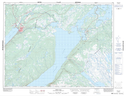
012H03 Deer Lake Canada topo map, 1:50,000 scale
012H03 Deer Lake NRCAN topographic map.
Includes UTM and GPS geographic coordinates (latitude and longitude). This 50k scale map is suitable for hiking, camping, and exploring, or you could frame it as a wall map.
Printed on-demand using high resolution, on heavy weight and acid free paper, or as an upgrade on a variety of synthetic materials.
Topos available on paper, Waterproof, Poly, or Tyvek. Usually shipping rolled, unless combined with other folded maps in one order.
- Product Number: NRCAN-012H03
- Parent Topo: TOPO-012H
- Map ID also known as: 012H03, 12H3, 12H03
- Unfolded Size: Approximately 26" high by 36" wide
- Weight (paper map): ca. 55 grams
- Map Type: POD NRCAN Topographic Map
- Map Scale: 1:50,000
- Geographical region: Newfoundland and Labrador, Canada
Neighboring Maps:
All neighboring Canadian topo maps are available for sale online at 1:50,000 scale.
Purchase the smaller scale map covering this area: Topo-012H
Spatial coverage:
Topo map sheet 012H03 Deer Lake covers the following places:
- Hicks Cove - Lynx Cove - Blow Hard Point - Grindstone Point - Hinds Point - Lunch Point - Wetstone Point - Howley Narrows - The Narrows - Bayleys Pond - Bugging Hole - Burnt Pond - Deer Lake - First Pond - Fool Pond - Gillards Pond - Glide Brook Steady - Glide Lake - Goose Steadies - Grand Lake - Hinds Lake - Horseshoe Pond - Johnsons Pond - Lacey Pond - Lanes Pond - Long Pond - Moose Pond - North Siding Pond - Old Mans Pond - Parmiters Pond - Pumphouse Pond - Reader Pond - Sandy Lake - Station Pond - Twin Ponds - Upper Glide Lake - Vye Pond - Conical Hill - The Topsails - Newfoundland T'Railway Provincial Park - Alder Brook - Blue Grass Brook - Boot Brook - Coal Brook - Coal Brook - Crooked Feeder - East Branch Forty-Five Brook - Glide Brook - Goose Brook - Hinds Brook - Horseshoe Brook - Humber Canal - Johnsons Brook - Junction Brook - Kelvin Brook - Kettle Creek - Lanes Brook - Mary Ann Brook - McGregor Brook - Middle Branch - Nichols Brook - North Harbour Brook - Pynns Brook - Rocky Brook - Sawmill Brook - Spillway - The Main Brook - The Spillway - Thirty-fifth Brook - Thirty-first Brook - Thirty-ninth Brook - Trout Brook - Upper Humber River - West Rocky Brook - Sandy Dump - Deer Lake - Howley - Reidville - Humber Canal - Junction Brook - Lake Siding - Lake Siding - Little Harbour - Main Dam - Nicholsville - Northern - Spillway - St. Judes - Intake Bog


