
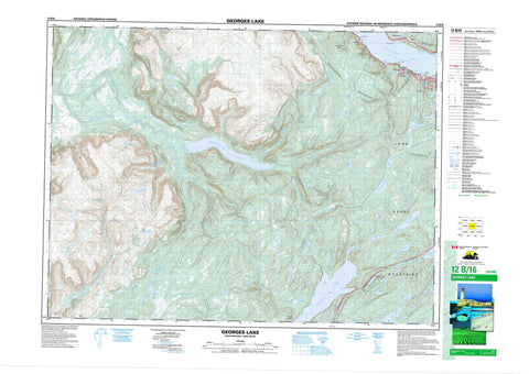
012B16 Georges Lake Canada topo map, 1:50,000 scale
012B16 Georges Lake NRCAN topographic map.
Includes UTM and GPS geographic coordinates (latitude and longitude). This 50k scale map is suitable for hiking, camping, and exploring, or you could frame it as a wall map.
Printed on-demand using high resolution, on heavy weight and acid free paper, or as an upgrade on a variety of synthetic materials.
Topos available on paper, Waterproof, Poly, or Tyvek. Usually shipping rolled, unless combined with other folded maps in one order.
- Product Number: NRCAN-012B16
- Parent Topo: TOPO-012B
- Map ID also known as: 012B16, 12B16
- Unfolded Size: Approximately 26" high by 36" wide
- Weight (paper map): ca. 55 grams
- Map Type: POD NRCAN Topographic Map
- Map Scale: 1:50,000
- Geographical region: Newfoundland and Labrador, Canada
Neighboring Maps:
All neighboring Canadian topo maps are available for sale online at 1:50,000 scale.
Purchase the smaller scale map covering this area: Topo-012B
Spatial coverage:
Topo map sheet 012B16 Georges Lake covers the following places:
- Bannatyne Cove - Cooks Cove - Davis Cove - Gum Cove - Humber Arm - Leahy Cove - Pleasant Cove - Giles Point - Halfway Point - Meadows Point - Petries Point - Spruce Point - Corner Brook - Barleys Pond - Beaver Pond - Big Cooks Pond - Big Gull Pond - Blue Pond - Blue Ponds - Buds Lake - Burnt Pond - Clarks Pond - Crooked Pond - Dozer Pond - First Pond - First Pond - Fourth Pond - Fox Pond - Georges Lake - Gull Pond Steadies - Gull Pond Steady - Gullet Pond - Hines Pond - Island Pond - Little Cooks Pond - Little St. George Pond - Meadows Pond - Old Mans Pond - Parmac Pond - Petleys Pond - Pinchgut Lake - Robinsons Ponds - Rocky Pond - Rocky Pond - Round Pond - Rushy Pond - Second Pond - Second Pond - Serpentine Lake - Sister Pond - Snooks Pond - South Pond - Stag Lake - Third Pond - Third Pond - Third Pond - Blue Hill - Cone Peak - Lewis Hills - Long Range Mountains - Mount Barren - Mount Moriah - Round Hill - Stag Hill - The Cabox - Blue Pond Provincial Park - Blue Ponds Provincial Park - Newfoundland T'Railway Provincial Park - Stag Lake Provincial Park - Allens Brook - Beaver Brook - Big Feeder Brook - Blue Hill Brook - Burnt Hill Brook - Camp 5 Brook - Camp 8 Brook - Camp Eleven Brook - Clarkes Brook West Branch - Clarks Brook - Coal River - Cooks Brook - East Blue Hill Brook - East North Brook - Fox Island River - Knights Brook - Little Feeder Brook - Middle Blue Hill Brook - Molly Ann Brook - Petries Brook - Phillips Brook - Pinchgut Brook - Red Barren Brook - Red Gulch Brook - Riley's Brook - Rope Cove Brook - Serpentine (Coal) River - Serpentine River - Simms Brook - Snooks Brook - Spruce Brook - St. Marys Brook - Vardy Brook - Wheelers Brook - Halfway Point-Benoit's Cove-John's Beach-Frenchman's Cove - Humber Arm South - Irishtown-Summerside - Meadows - Mount Moriah - Beaver - Beaver Pond - Cooke - Cooks Brook - Georgetown - Halfway Point - Howards - Petries - Serpentine - Sopers - Spruce Brook - Rope Cove Canyon


