
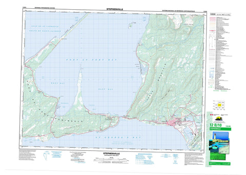
012B10 Stephenville Canada topo map, 1:50,000 scale
012B10 Stephenville NRCAN topographic map.
Includes UTM and GPS geographic coordinates (latitude and longitude). This 50k scale map is suitable for hiking, camping, and exploring, or you could frame it as a wall map.
Printed on-demand using high resolution, on heavy weight and acid free paper, or as an upgrade on a variety of synthetic materials.
Topos available on paper, Waterproof, Poly, or Tyvek. Usually shipping rolled, unless combined with other folded maps in one order.
- Product Number: NRCAN-012B10
- Parent Topo: TOPO-012B
- Map ID also known as: 012B10, 12B10
- Unfolded Size: Approximately 26" high by 36" wide
- Weight (paper map): ca. 55 grams
- Map Type: POD NRCAN Topographic Map
- Map Scale: 1:50,000
- Geographical region: Newfoundland and Labrador, Canada
Neighboring Maps:
All neighboring Canadian topo maps are available for sale online at 1:50,000 scale.
Purchase the smaller scale map covering this area: Topo-012B
Spatial coverage:
Topo map sheet 012B10 Stephenville covers the following places:
- Abrahams Cove - Bellmans Cove - Bellman's Cove - Belmans Cove - Campbells Cove - Costa Bay - East Bay - East Road - Felix Cove - Fiods Cove - Golfe du Saint-Laurent - Gulf of St. Lawrence - Head Harbour - Isthmus Bay - Lead Cove - Piccadilly Bay - Port au Port Bay - Port Harmon - Rothesay Bay - Ship Cove - St. George's Bay - West Bay - West Road - The Bar - Black Point - Indian Head - Port au Port Peninsula - Road Point - Rocky Point - Shoal Point - South Head - Fox Island - Ship Island - Cache Pond - Gravels Pond - Gull Pond - Labrador Pond - Noels Pond - Stephenville Pond - Two Guts Pond - Indian Head Range - Pierways Hill - Rabbit Hill - Table Mountain - Whale Back Ridge - Piccadilly Head Provincial Park - Point au Mal Provincial Park - Black Duck Brook - Blanche Brook - Cold Brook - Fox Island River - Gadons Brook - Harry Brook - Jack of Clubs Brook - Little River - Lourdes Brook - Phillips Brook - Rioux Brook - Romaines Brook - Smelt Brook - South Brook - Victor Brook - Victors Brook - Warm Brook - Warm Creek - American Bank - Gravels Bank - North Rock - Turning Basin - Kippens - Lourdes - Port au Port East - Port au Port West-Aguathuna-Felix Cove - Stephenville - Abrahams Cove - Aguathuna - Bellmans Cove - Black Duck Brook - Black Duck Brook-Winterhouse - Boswarlos - Campbells Creek - Cold Brook - Felix Cove - Fox Island River - Fox Island River-Point au Mal - Jerrys Nose - Kippensville - Man of War Cove - Noels Pond - Picadilly-Abrahams Cove - Piccadilly - Piccadilly Head - Piccadilly Slant - Piccadilly Slant-Abrahams Cove - Point au Mal - Port au Port - Romaines - Ship Cove - Ship Cove-Lower Cove - Ship Cove-Lower Cove-Jerry's Nose - Tea Cove - The Gravels - West Bay - West Bay - West Bay Centre - Winterhouse - Cache Valley - Berry Head


