
012B07 Flat Bay Canada topo map, 1:50,000 scale
012B07 Flat Bay NRCAN topographic map.
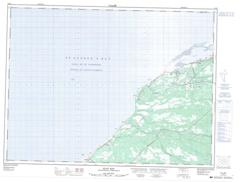
Includes UTM and GPS geographic coordinates (latitude and longitude). This 50k scale map is suitable for hiking, camping, and exploring, or you could frame it as a wall map.
Printed on-demand using high resolution, on heavy weight and acid free paper, or as an upgrade on a variety of synthetic materials.
Topos available on paper, Waterproof, Poly, or Tyvek. Usually shipping rolled, unless combined with other folded maps in one order.
- Product Number: NRCAN-012B07
- Parent Topo: TOPO-012B
- Map ID also known as: 012B07, 12B7, 12B07
- Unfolded Size: Approximately 26" high by 36" wide
- Weight (paper map): ca. 55 grams
- Map Type: POD NRCAN Topographic Map
- Map Scale: 1:50,000
- Geographical region: Newfoundland and Labrador, Canada
Neighboring Maps:
All neighboring Canadian topo maps are available for sale online at 1:50,000 scale.
Purchase the smaller scale map covering this area: Topo-012B
Spatial coverage:
Topo map sheet 012B07 Flat Bay covers the following places:
- Bank Head Cove - Flat Bay - Golfe du Saint-Laurent - Gulf of St. Lawrence - Muddy Hole - Rothesay Bay - Shallop Cove - St. George's Bay - Stinking Cove - Youngs Cove - Bank Head - Berry Head - Indian Head - Jacotar Point - Long Point - Mistyglee Brook Point - Robinsons Head - Rocky Point - Shallop Point - Flat Island - Moyac Island - Big Rushy Pond - Fairy Pond - Flat Bay Pond - Journois Pond - Longbyes Pond - Noels Pond - Rocky Ponds - Round Pond - Rushy Pond - Sink Hole Pond - Uncle Joes Pond - Newfoundland T'Railway Provincial Park - Barry Brook - China Brook - Clam Brook - Dribble Brook - Fischells Brook - Fischells Dribble - Flat Bay Brook - Irishmans Brook - Journois Brook - Middle Brook - Mistyglee Brook - Plaster Brook - Rattling Brook - Red Brook - Seal Brook - Cobbs Pool - Round Pool - St. George's - Bay St. George South - Fischells - Flat Bay - Flat Bay West - Heatherton - Journois - Joyce - Robinsons - Robinson's Station - Sandy Point - Shallop Cove - St. Teresa - St. Teresa


