
012B02 St Fintan s Canada topo map, 1:50,000 scale
012B02 St Fintan s NRCAN topographic map.
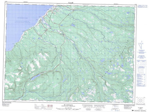
Includes UTM and GPS geographic coordinates (latitude and longitude). This 50k scale map is suitable for hiking, camping, and exploring, or you could frame it as a wall map.
Printed on-demand using high resolution, on heavy weight and acid free paper, or as an upgrade on a variety of synthetic materials.
Topos available on paper, Waterproof, Poly, or Tyvek. Usually shipping rolled, unless combined with other folded maps in one order.
- Product Number: NRCAN-012B02
- Parent Topo: TOPO-012B
- Map ID also known as: 012B02, 12B2, 12B02
- Unfolded Size: Approximately 26" high by 36" wide
- Weight (paper map): ca. 55 grams
- Map Type: POD NRCAN Topographic Map
- Map Scale: 1:50,000
- Geographical region: Newfoundland and Labrador, Canada
Neighboring Maps:
All neighboring Canadian topo maps are available for sale online at 1:50,000 scale.
Purchase the smaller scale map covering this area: Topo-012B
Spatial coverage:
Topo map sheet 012B02 St Fintan s covers the following places:
- Eel Hole - Golfe du Saint-Laurent - Gulf of St. Lawrence - Plaster Cove - Ship Cove - St. George's Bay - Bluff Head - Crabbes Head - Harbour Head - Pond Point - Shoal Point - The Highlands - Big Otter Pond - Bill Shears Pond - Bluchers Pond - Bluff Head Pond - Codroy Pond - Hungry Grove Pond - Little Otter Pond - Loch Leven - Mitchells Pond - Morris Brook Pond - Ocean Pond - Ocean Pond - Shoal Point Pond - Taylors Pond - Tom Diamond Pond - Tom Evans Pond - Tuckers Pond - Two Diamonds Pond - Anguille Mountains - Bald Mountain - Crabbes Hill - Long Range Mountains - Crabbes River Provincial Park - Newfoundland T'Railway Provincial Park - Bald Mountain Brook - Barachois Brook - Butter Brook - Crabbes Brook - Crabbes River - Crooked Brook - Fischells Dribble - French Brook - Highlands River - Little Brook - Little Crabbes Brook - Little Spout Brook - McLellans Brook - Middle Barachois River - Morris Brook - North Branch - North Branch - Northern Feeder - Rainy Brook - Rainy Brook East - Robinsons River - Ship Brook - Shoal Point Brook - Ship Rock - Bay St. George South - Cartyville - Codroy Pond - Highlands - Jeffrey's - Loch Leven - Lockleven - Maidstone - McKay's - River Brook - Robinsons - Robinson's Station - St. David's - St. Fintan's - Pauls Gulch - The Spout Gulch


