
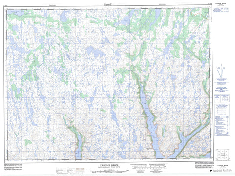
011P16 D Espoir Brook Canada topo map, 1:50,000 scale
011P16 D Espoir Brook NRCAN topographic map.
Includes UTM and GPS geographic coordinates (latitude and longitude). This 50k scale map is suitable for hiking, camping, and exploring, or you could frame it as a wall map.
Printed on-demand using high resolution, on heavy weight and acid free paper, or as an upgrade on a variety of synthetic materials.
Topos available on paper, Waterproof, Poly, or Tyvek. Usually shipping rolled, unless combined with other folded maps in one order.
- Product Number: NRCAN-011P16
- Parent Topo: TOPO-011P
- Map ID also known as: 011P16, 11P16
- Unfolded Size: Approximately 26" high by 36" wide
- Weight (paper map): ca. 55 grams
- Map Type: POD NRCAN Topographic Map
- Map Scale: 1:50,000
- Geographical region: Newfoundland and Labrador, Canada
Neighboring Maps:
All neighboring Canadian topo maps are available for sale online at 1:50,000 scale.
Purchase the smaller scale map covering this area: Topo-011P
Spatial coverage:
Topo map sheet 011P16 D Espoir Brook covers the following places:
- Bay d'Espoir - Big Boat Cove - Boat Cove - Burn Cove - Burnt Cove - Charlottetown Bottom - Cul de Sac - Doting Cove - East Bay - Facheux Bay - First Bight - Garland Cove - Grandfather Nashs Cove - Green Cove - Island Cove - Kings Cove - Larner Cove - Little Boat Cove - Little Doting Cove - North Bay - Northwest Cove - Organ Bight - Pomley Cove - Second Bight - Second Brook Cove - Stones Point Cove - The Barasway - Thomey Cove - Woody Bight - Woody Bight - Bald Point - Barasway Point - Birchy Point - Dog Point - Hughes Head - Hughes Point - Indian Point - Lazarus Point - Little Bald Point - Otter Rub Head - Rowsells Point - The White Horse - Tickle Point - White Point - Wilcott (Pullett) Point - Wilcott Point - Icy Scrape - Bear Lake - Beaver Pond - Black Duck Pond - D'Espoir Lake - Dollard Pond - Jeddore Lake - Morris Pond - Nicholas Pond - Sandy Pond - Seven Island Pond - Boiler Hill - Devils Dancing Table - Morris Hill - Round Hill - Whales Back - Beaver Brook - Bottom Brook - Cross Brook - D'Espoir Brook - Eastern Brook - First Brook - Hughes Brook - Morgan Brook - Penny Brook - Salmon River - Shoal Brook - Western Brook - Brem Bank - Dog Rock - Dogberry Rock


