
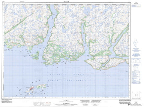
011P11 Ramea Canada topo map, 1:50,000 scale
011P11 Ramea NRCAN topographic map.
Includes UTM and GPS geographic coordinates (latitude and longitude). This 50k scale map is suitable for hiking, camping, and exploring, or you could frame it as a wall map.
Printed on-demand using high resolution, on heavy weight and acid free paper, or as an upgrade on a variety of synthetic materials.
Topos available on paper, Waterproof, Poly, or Tyvek. Usually shipping rolled, unless combined with other folded maps in one order.
- Product Number: NRCAN-011P11
- Parent Topo: TOPO-011P
- Map ID also known as: 011P11, 11P11
- Unfolded Size: Approximately 26" high by 36" wide
- Weight (paper map): ca. 55 grams
- Map Type: POD NRCAN Topographic Map
- Map Scale: 1:50,000
- Geographical region: Newfoundland and Labrador, Canada
Neighboring Maps:
All neighboring Canadian topo maps are available for sale online at 1:50,000 scale.
Purchase the smaller scale map covering this area: Topo-011P
Spatial coverage:
Topo map sheet 011P11 Ramea covers the following places:
- Bay de Vieux - Ben Keepings Cove - Big Cove - Birchy Cove - Brimball Storehouse Cove - Bucks Hole - Buffetts Cove - Caplin Cove - Coopers Cove - Coppett Harbour - Cork Hole - Cul de Sac Harbour - Doctor Harbour - Doctor Harbour - Dog Cove - Eastern Harbour - Emily Storehouse Cove - Fox Hole - Fox Island Harbour - Frenchman Cove - Frenchmans Cove - Georges Cove - Gulch Cove - Gulf Cove - Hoist Sail Cove - Island Cove - Jacksons Hole - Jerts Cove - Jigging Cove - Keepings Cove - Little Dog Cove - Mosquito Harbour - Muddy Harbour - Northeast Arm - Northeast Arm - Northeast Cove - Northwest Arm - Ramea Harbour - Rinding Hole - Rudder Cove - Ship Cove - Shoal Cove - Shoal Cove - Southeast Arm - Squier Back Cove - Squier Cove - Stones Cove - The Nook - Thomas Cove - Turks Cove - White Bear Bay - White Point Cove - Whiz-ma-jig - Winter House Cove - Wreck Cove - Har Sands - Bald Point - Bear Head - Blow Me Down Point - Bonnels Point - Conners Nose - Crow Head - East Point - East Point - Eastern End - Fender Point - Fish Head - Georges Cove Head - Grey River Point - Horse Head - Northeast Point - Northwest Head - Northwest Head - Northwest Head - Pinks Point - Salmon Net Head - Turks Head - West Point - West Point - Western Head - White Point - Narrows - Northeast Passage - Shoal Passage - Blow Me Down - Bear Island - Black Island - Copper Island - Deer Island - Denny Island - Eastern Harbour Island - Fish Island - Flat Island - Fox Island - Gnat Island - Great Island - Grip Island - Gulch Cove Islands - Gull Island - Gull Island - Harbour Island - Iron Island - Little Gull Island - Long Island - Middle Island - Northwest Island - Not Island - Pinks Point Isle - Puffin Island - Ramea Colombier - Ramea Islands - Round Island - Seal Island - Shag Islands - Southwest Island - Susan Island - Three Islands - Turks Island - Turnip Island - Turr Island - Turr Islets - White Island - White Island - Woody Island - Admirals Pond - Big Pond - Cart Pond - Georges Cove Pond - Island Pond - Northwest Pond - Slop Dish - Vamp Pond - Billys Hill - Buffetts Lookout - Colliers Hill - Devils Knob - Gull Hill - High Ridge - Man of War Hill - Rocky Ridge - The Nugget - Vamp Pond Ridges - Bay de Loup Brook - Dry Brook - Fish Brook - Grey River - Kings Harbour Brook - Northwest Brook - Seal Brook - Slip Brook - Southeast Brook - Anderson Rock - Anderson Sunkers - Bad Neighbour - Bad Rock - Black Rock - Black Rock - Black Sunker - Cul de Sac Rocks - East Black Rock - Eastern Rock - Eastern Rock Shoal - Fish Island Shoal - Fox Island Rock - Good Rock - Gull Island Shoal - Gull Rock - Lizard Rock - Northward Rocks - Offer Sunker - Old Man Shoal - Samuel Shoal - Seal Rocks - Shag Islands Shoal - Ship Shoal - Southwest Rocks - Tom Rock - West Black Rock - White Rock - Ramea - Bonalds Island - Bonald's Island - Coppett - Deer Island - Dog Cove - Fox Island Harbour - Grey River - Red Island


