
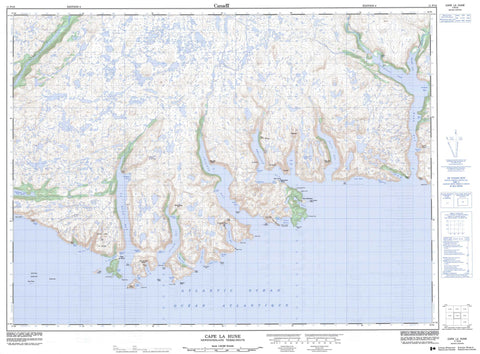
011P10 Cape La Hune Canada topo map, 1:50,000 scale
011P10 Cape La Hune NRCAN topographic map.
Includes UTM and GPS geographic coordinates (latitude and longitude). This 50k scale map is suitable for hiking, camping, and exploring, or you could frame it as a wall map.
Printed on-demand using high resolution, on heavy weight and acid free paper, or as an upgrade on a variety of synthetic materials.
Topos available on paper, Waterproof, Poly, or Tyvek. Usually shipping rolled, unless combined with other folded maps in one order.
- Product Number: NRCAN-011P10
- Parent Topo: TOPO-011P
- Map ID also known as: 011P10, 11P10
- Unfolded Size: Approximately 26" high by 36" wide
- Weight (paper map): ca. 55 grams
- Map Type: POD NRCAN Topographic Map
- Map Scale: 1:50,000
- Geographical region: Newfoundland and Labrador, Canada
Neighboring Maps:
All neighboring Canadian topo maps are available for sale online at 1:50,000 scale.
Purchase the smaller scale map covering this area: Topo-011P
Spatial coverage:
Topo map sheet 011P10 Cape La Hune covers the following places:
- Aviron Bay - Bagg Cove - Barasway - Barrisway Cove - Black Cove - Bob Lock Cove - Brandy Cove - Cape Cove - Chaleur Bay - Chaleur Harbour - Cooper Cove - Cul de Sac - Cul de Sac - Deadman Cove - Devil Bay - Dolland Bight - Dorton Cove - Fannys Black Hole - Foots Cove - François Bay - Friar Cove - Hare Bay - Hauling Up Cove - Hemlock Cove - Herringnet Cove - Hollingshead Cove - La Hune Bay - La Hune Harbour - Lance Cove - Little Bay - Long Bight - Mare Cove - Mitchell Cove - Moodys Cove - Morgan Arm - Moulton Cove - New Harbour - Nick Power Cove - Northeast Cove - Northeast Cove - Northwest Arm - Paddle Cove - Rencontre Bay - Save All Hole - Seals Rest Cove - Southeast Arm - Southeast Bight - The Cove - Wild Cove - The Beach - The Reef - Aviron Point - Bagg Head - Barley Point - Battery Point - Bill of Lance Cove Point - Black Head - Black Point - Brandy Head - Cape La Hune - Coopers Head - Dorton Head - Doughball Point - East Point - Eastern Head - Funnel Head - Grip Head - Hares Ears Point - Lance Cove Point - Lance Cove Promontory - Little Bay Cove Point - Long Point - Long Point - Long Point - Nick Power Point - Pinchgut Point - Red Point - Sandy Point - Shooter Point - Stake Point - Styles Point - West Point - West Point - West Point - Western Head - Blow Me Down - Aviron Falls - Cape Island - Gull Island - Harry Island - New Harbour Island - The Friar - Bagg Pond - Bagg Pond - Big Pond - Bill Whites Pond - Goose Pond - Greeps Nest Pond - Gull Pond - Man Pond - Middle Pond - Our Pond - Stage Pond - Two Mile Pond - Bagg Hill - Big Hill - Flagstaff Hill - Good Friday Hill - High Land of La Hune - High Lookout - Ironskull - Northwest Hill - Notch Block Hill - Peters Hill - Pinks Hill - St. Alban's - St. Ilian's - Sugarloaf - The Friar - Tolt - Wax Chimney - Dolland Brook - Dry Brook - Grey River - Herring Net Brook - Michaels Brook - Morgan Brook - Rattling Brook - Salmon Brook - The Brook - Tilt Brook - Aviron Rock - Black Rock - Bob Shoal - Cape Rocks - Distress Rock - Eastern Shoal - Hares Ears Rock - John Pink Shoal - Long Point Shoal - Loon Rocks - Lower Rock - Middle Rock - Naked Man - North Rock - Red Point Rock - Satchel Shoal Rock - Southwest Shoal - Cape la Hune - Cul de Sac West - François - Locks Cove - New Harbour - Parsons Harbour - Rencontre West - The Gorge


