
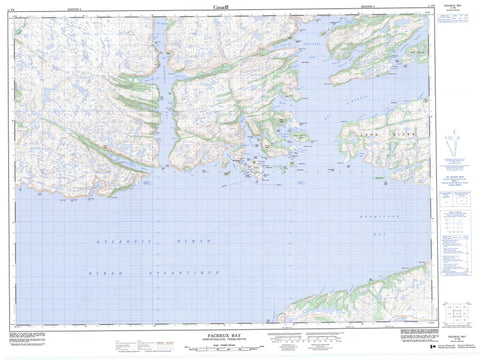
011P09 Facheux Bay Canada topo map, 1:50,000 scale
011P09 Facheux Bay NRCAN topographic map.
Includes UTM and GPS geographic coordinates (latitude and longitude). This 50k scale map is suitable for hiking, camping, and exploring, or you could frame it as a wall map.
Printed on-demand using high resolution, on heavy weight and acid free paper, or as an upgrade on a variety of synthetic materials.
Topos available on paper, Waterproof, Poly, or Tyvek. Usually shipping rolled, unless combined with other folded maps in one order.
- Product Number: NRCAN-011P09
- Parent Topo: TOPO-011P
- Map ID also known as: 011P09, 11P9, 11P09
- Unfolded Size: Approximately 26" high by 36" wide
- Weight (paper map): ca. 55 grams
- Map Type: POD NRCAN Topographic Map
- Map Scale: 1:50,000
- Geographical region: Newfoundland and Labrador, Canada
Neighboring Maps:
All neighboring Canadian topo maps are available for sale online at 1:50,000 scale.
Purchase the smaller scale map covering this area: Topo-011P
Spatial coverage:
Topo map sheet 011P09 Facheux Bay covers the following places:
- Alder Cove - Allan Cove - Back Cove - Bay d'Espoir - Big Harbour - Birchy Cove - Blow Hole - Blunder Cove - Bonne Bay - Bonne Bay Harbour - Brent Cove - Bull Cove - Butter Cove - Chambers Harbour - Clay Cove - Clay Hole - Colliers Cove - Crew Cove - Cribbs Cove - Cul de Sac - Daniels Hole - Davy Downs Cove - Dennis Arm - Diamond Cove - Dorys Cove - Doughball Cove - Dragon Bay - Eastern Bottom - Eastern Cove - Engine Cove - Facheux Bay - Facheux Eye - Facheux Harbour - Fox Cove - Goblin Bay - Grassy Cove - Great Cove - Great Cuiller Bay - Great Jervis Harbour - Green Bottom - Green Point Cove - Grip Cove - Grole Cove - Grole Western Cove - Hardy Cove - Hardy Cove - Hardy Cove - Hardys Cove - Hatcher Cove - Hermitage Bay - Herring Cove - Indian Cove - Jigging Cove - Jim Morris Cove - John Willmotts Cove - Kearleys Cove - Kent Cove - Killbuck Cove - King Cove - Lee Cove - Lees Cove - Little Bay - Little Cove - Little Cuiller Bay - Little Goblin Bay - Little Harbour - Lobscouse Cove - Long Beach Cove - Man of War Cove - Manuel Arm - Middle Goblin Bay - Mooring Cove - Mosquito Harbour - Muddy Hole - North Bay - Northern Arm - Northwest Cove - Northwest Cove - Northwest Droke Cove - Patrick Harbour - Patricks Harbour - Patricks Harbour Eastern Cove - Pomley Cove - Pot Harbour - Potato Cove - Richards Harbour - Rose Cove - Rotten Row - Round Harbour - Sam Hitches Harbour - Sand Hole - Seal Rock Cove - Seal Rock Cove - Shallop Cove - Shoal Cove - Skiff Cove - Skiff Cove - Skiff Cove - Southern Harbour - Stanley Cove - Stephens Hole - The Barasway - The Barasway - The Bight - The Hole - Tickle Cove - Trap Cove - Tumbling Hole - Uncle Georges Cove - V and I Cove - Victoria Cove - Wallace Cove - Warren Cove - Western Bottom - Western Harbour - Whiting Cove - Wild Cove - Wild Cove - Wild Cove - Wild Cove - Willis Cove - Winter House Cove - Wreck Cove - Allan Head - Bald Point - Bear Head - Ben Kent Head - Big Head - Black Head - Black Otter Rub - Bluff Point - Bonne Bay Head - Brent Cove Head - Buffett Point - Buffett Point - Carolines Ballast Rubble - Cemetry Point - Cleavers Head - Copper Head - Crib Nose - Cul de Sac Point - Davy Downs Head - Dawson Point - Dogfish Point - Doughball Point - Eastern Head - Eastern Sam Hitches Head - Fish Head - Fish Point - Fish Point - Fishes Nose Point - Goblin Head - Great Cuiller Point - Great Jervis Head - Green Point - Grip Head - Halfway Point - Hardy Point - Indian Tea Point - Jas Rose Point - Little Bay Head - Long Point - Lower Shoal Point - North Bay Head - Old Womans Point - Pilgrims Point - Poole Point - Red Head - Red Point - Rogers Head - Salmon Point - Sand Point - Short Point - Spruce Point - Stone Point - Sugarloaf Point - The Hummick - Thorofare Point - Upper Shoal Point - Wallace Head - West Head - Western Head - Western Head - Western Head - Western Sam Hitches Head - White Head - White Point - Wild Cove Head - Wild Cove Head - Wild Cove Point - Wilsons Point - Buffett Tickle - Lampidoes Passage - Pass Island Tickle - Pushthrough - Raymond Passage - The Topsail - Mare Falls - Blow Island - Bois Island - Daniel Island - Drake Island - Grassy Island - Great Jervis Island - Grip Island - Gull Island - Inside Gull Island - Little Raymond Island - Long Island - Middle Island - Mosquito Island - Outside Gull Island - Pass My Can Island - Pass my can Island - Pearl Island - Pigeon Island - Pigeon Island - Poole Island - Raymond Island - Saddle Island - Stone Island - Sugarloaf Island - Taylor Island - Whale Island - Big Barasway - Eastern Black Duck Pond - Northwest Cove Inside Pond - Northwest Cove Outside Pond - Trout Brook Pond - Western Black Duck Pond - Winter House Cove Pond - Big Hill - Bonne Peak - Chock Hill - Cook Hill - Harbour Le Gallais Hill - Old Hills - Stairs - Allan's Cove Brook - Big Brook - Bottom Brook - Dry Brook - Horse Brook - Morgan Brook - Trout Brook - Long Reach - Matt Lees Way - Big Shoal - Black Rock - Black Rock - Black Rock Shoal - Bonne Bay Shoal - Crib Nose Shoal - David Walshs Sunker - Davy Shoal - Dawson Shoal - Dogfish Shoal - Dory Rock - Eastern Rock - Facheux Head Shoal - Fish Rocks - Grandy Rocks - Grip Cove Rock - Grip Head Rock - Gull Rock - Halibut Rocks - Hardy Rock - Hatcher Shoal - Head Rock - Island Rock - Kelpy Rock - Large Rock - Long Island Rock - Man of War Rocks - Mark Rocks - Mark Rocks Shoal - Middle Rock - Mosquito Shoal - Mouse Bank - New Bank - Offer Shoal - Old Bank - Old Harry - Pack Shoal - Patrick Harbour Rock - Paul Shoal - Pigeon Head Shoal - Pigeon Island Shoal - Pigeon Shoal - Razorback Rock - Seal Rocks - Shag Rocks - Shag Rocks - Shoal Point Rock - Squid Rock - Taylor Rock - The Brothers - Tinker Rock - Tom Cod Rock - Tom Rose Shoal - Topsail Shoal - Vessel Rock - Whale Rock - White Rock - Wild Cove Rocks - Goblin - Great Jervis Harbour - Grole - Little Bay - McCallum - Muddy Hole - Patricks Harbour - Patrick's Harbour - Pushthrough - Richard's Harbour - Round Harbour - Stanley Cove - Stone Valley - East Gulch - The Marsh


