
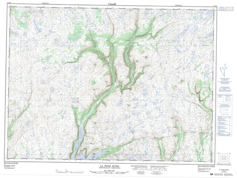
011O16 La Poile River Canada topo map, 1:50,000 scale
011O16 La Poile River NRCAN topographic map.
Includes UTM and GPS geographic coordinates (latitude and longitude). This 50k scale map is suitable for hiking, camping, and exploring, or you could frame it as a wall map.
Printed on-demand using high resolution, on heavy weight and acid free paper, or as an upgrade on a variety of synthetic materials.
Topos available on paper, Waterproof, Poly, or Tyvek. Usually shipping rolled, unless combined with other folded maps in one order.
- Product Number: NRCAN-011O16
- Parent Topo: TOPO-011O
- Map ID also known as: 011O16, 11O16
- Unfolded Size: Approximately 26" high by 36" wide
- Weight (paper map): ca. 55 grams
- Map Type: POD NRCAN Topographic Map
- Map Scale: 1:50,000
- Geographical region: Newfoundland and Labrador, Canada
Neighboring Maps:
All neighboring Canadian topo maps are available for sale online at 1:50,000 scale.
Purchase the smaller scale map covering this area: Topo-011O
Spatial coverage:
Topo map sheet 011O16 La Poile River covers the following places:
- Bakers Cove - Dolman Cove - North Bay - Northeast Arm - Bakers Spit - Birchey Head - Dolman Head - The Narrows - Big Otter Pond - Big Pond - Bolt Pond - Cooks Pond - Lake Margaret - Mouse Pond - Rocky Ridge Pond - Strickland Pond - Trout Pond - Wiggly Pond - Baggs Hill - Barnes Hill - Bennett Hill - Berteau Hill - Eastern Fox Hill - Eastern Gunflap Hill - Eight Mile Hill - Inner Gunflap Hill - Long Range Mountains - Rocky Ridge - Western Fox Hill - Western Gunflap Hill - Ackerman Brook - Bakers Brook - Big Pond Brook - Broad Cove Brook - Bunker Hill Brook - Burke Brook - Carrot Brook - Cascade Brook - Cinq Cerf Brook - Couteau Brook - Deep Brook - East Bay Brook - Farmers Brook - Fox Hole Brook - Garia Brook - Gooseberry Brook - La Poile River - Mitchells Brook - Morg Keepings Brook - Mouse Pond Brook - Northwest Brook - Phillips Brook - Rattling Brook - Rocky Ridge Brook - Round Hill Brook - Salmon Hole Brook - Two Way Brook - Woody Brook - East Bay - North Bay - Cross Gulch


