
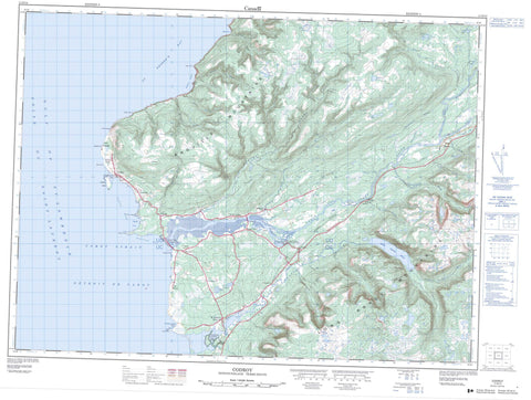
011O14 Codroy Canada topo map, 1:50,000 scale
011O14 Codroy NRCAN topographic map.
Includes UTM and GPS geographic coordinates (latitude and longitude). This 50k scale map is suitable for hiking, camping, and exploring, or you could frame it as a wall map.
Printed on-demand using high resolution, on heavy weight and acid free paper, or as an upgrade on a variety of synthetic materials.
Topos available on paper, Waterproof, Poly, or Tyvek. Usually shipping rolled, unless combined with other folded maps in one order.
- Product Number: NRCAN-011O14
- Parent Topo: TOPO-011O
- Map ID also known as: 011O14, 11O14
- Unfolded Size: Approximately 26" high by 36" wide
- Weight (paper map): ca. 55 grams
- Map Type: POD NRCAN Topographic Map
- Map Scale: 1:50,000
- Geographical region: Newfoundland and Labrador, Canada
Neighboring Maps:
All neighboring Canadian topo maps are available for sale online at 1:50,000 scale.
Purchase the smaller scale map covering this area: Topo-011O
Spatial coverage:
Topo map sheet 011O14 Codroy covers the following places:
- Capelan Cove - Capelin Cove - Codroy Road - Friars Cove - Golfe du Saint-Laurent - Gulf of St. Lawrence - Net Cove - Northwest Cove - Searston Bay - Snakes Bight - The Gut - Beach Point - Cape Anguille - Cape John - George Point - Grebes Head - Kennedy Point - Kennel Head - LarkinPoint - Shoal Point - Stormy Point - Woody Cape - Cabot Strait - Détroit de Cabot - Codroy Island - Holy Cross Island - Friars Ponds - Hynes Ponds - Johns Pond - Little Codroy Pond - Loch Lomond - Long Pond - Mitchells Pond - Shoal Pond - Wedding Pond - Woodpecker Pond - Long Range Mountains - Codroy Valley Beach Provincial Park - Codroy Valley Provincial Park - Grand Codroy Provincial Park - Mummichog Provincial Park - Newfoundland T'Railway Provincial Park - Big Brook - Brooms Brook - Grand Bay River - Grand Codroy River - Grand Daddys Brook - Johns Brook - Kennel Brook - Limestone Brook - Little Codroy River - Low Brook - Mollichignick Brook - Muddy Hole Brook - Muises Brook - North Branch - Overfall Brook - Ryans Brook - Scythestone Brook - Smokehouse Brook - South Branch - Spout Brook - Stephens Brook - Fish Rock - Net Rock - Three Rocks - Benoits Siding - Cape Anguille - Codroy - Doyles - Great Codroy - Millville - O'Regan's - Searston - Shoal Point - South Branch - St. Andrew's - The Block - Tompkins - Upper Ferry - Woodville - Friars Gulch


