
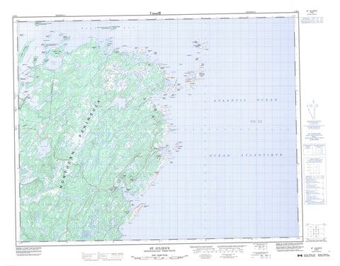
002M04 St Julien s Canada topo map, 1:50,000 scale
002M04 St Julien s NRCAN topographic map.
Includes UTM and GPS geographic coordinates (latitude and longitude). This 50k scale map is suitable for hiking, camping, and exploring, or you could frame it as a wall map.
Printed on-demand using high resolution, on heavy weight and acid free paper, or as an upgrade on a variety of synthetic materials.
Topos available on paper, Waterproof, Poly, or Tyvek. Usually shipping rolled, unless combined with other folded maps in one order.
- Product Number: NRCAN-002M04
- Parent Topo: TOPO-002M
- Map ID also known as: 002M04, 02M4, 2M4, 02M04, 2M04
- Unfolded Size: Approximately 26" high by 36" wide
- Weight (paper map): ca. 55 grams
- Map Type: POD NRCAN Topographic Map
- Map Scale: 1:50,000
- Geographical region: Newfoundland and Labrador, Canada
Neighboring Maps:
All neighboring Canadian topo maps are available for sale online at 1:50,000 scale.
Purchase the smaller scale map covering this area: Topo-002M
Spatial coverage:
Topo map sheet 002M04 St Julien s covers the following places:
- Admiralty Cove - Ariege (Belvy) Bay - Bière Cove - Big Spring Inlet - Buse Point Bay - Canada Cove - Capelan Bay - Capelaniers Bay - Caplan Bay - Corbeau Cove - Courlieux Cove - Cow Bay - Croque Harbour - Deep Bay - Drac Bay - Épine Cadoret - Fischot Harbour - Fishermans Cove - Flamands Cove - Four Harbour - Grandois Harbour - Great Buse Bay - Great Islets Harbour - Great St. Julien Harbour - Green Cove - Grise Point Bay - Groux Bay - Hare Bay - Houardin Cove - Irish Bay - Kearney Cove - Landing Cove - Large Stone Bay - Le Fond - Little Islets Harbour - Little Spring Inlet - Little St. Julien Harbour - Long Bay - Maiden Arm - Million Cove - Moules Bay - Park Cove - Pelletier Bay - Plover Bay - Port Cove - Prince Edward Bay - Salmon Bay - Sculpin Gulch - Shoal Arm - Southern Arm - Square Cove - Starboard Cove - Trois Isles Bay - Trompeuse Bay - Verte Bay - Virgin Bay - W Cove - Bald Head - Blanche Point - Bonhomme Point - Burnt Point - Calas Point - Cape Croix - Cape Eagle - Chevaliers Point - Cow Point - Echelle Point - Genille Point - Grelins Point - Grise Point - Groux Point - Hacketts Head - Indre Point - Jeanne Point - Jehenne Point - Johnson Point - La Source Point - Little St. Julien Point - Loup Marin Point - Maiden Point - Malouine Point - Moustiques Point - Northeast Point - Northern Peninsula - Observation Point - Point Enragée (Fish Point) - Pointe à l'Aurore - Rets Point - River Point - Sculpin Point - Tortoise Point - Vide Bidon Point - Watering Cove Point - Windy Point - American Tickle - Easter Tickle - Fischot Channel - Le Goulot - St. Julien Tickle - Bare Island - Basse Island - Bigue Island - Black Island - Brent Islands - Cailloux Island - Chaberet Island - Charles Island - Chasseurs Island - Corbeau Island - Deaths Head Island - Demètre Island - Devarenne (Bushy) Island - Direction Island - Double Island - Elizabeth Island - English Island - Fischot Island - Frommy Island - Gilliat Island - Goelands Island - Goose Island - Great Cormorandier Island - Great Verdon Island - Gros Plomb Island - Little Cormorandier Island - Little Madame Island - Little Verdon Island - Long Island - Louisa Island - MacGray Island - Madame Island - Maria Island - Massacre Island - Melier Island - Monk Island - Northeast Island - Observatory Island - Paul Island - Petit Rocher - Pigeon Island - Port Island - Pouilleux Island - Pradet Island - Shoal Arm Island - South Island - Spring Island - St. Julien Island - Starboard Island - Coles Pond - Salt Pond - Tom Roses Pond - White Hump Pond - Alma Hill - Bay Peak - Boussole Hill - Direction Hill - Forest Hill - Genille Peak - Great Buse - La Source Hill - Little Buse - St. Julien Peak - The Peak - Tortoise Hill - Hare Bay Ecological Reserve - Hare Bay Seabird Ecological Reserve - Cascade Stream - Freshwater Creek - Baleineau Ledge - Brent Rock - Bruyantes Rock - Buse Point Bank - Camus Shoal - Corlet Shoal - Cow Shoal - Direction Reef - Duchayla Rock - Glaziou Shoal - Goelands Rock - Great Cormorandier Rock - Indre Shoal - Jehenne Shoal - La Baleine Rock - La Baleine Rock - Le Muloux - Lecorre Rock - Legendre Shoal - Louis Lemaire Shoal - Massacre Rock - Melier Rock - Melier Shoal - Mid-Channel Rock - Mulou Shoal - Northwest Shoal - Piroque Shoal - Répissé Shoal - Ship Shoal - Souriceau Rock - Souris Rock - Sournoise Shoal - Tetard Bank - Thistle Shoal - Virgin Shoal - Main Brook - Burnt Village - Croque - Croque - Croque - Fischot Islands - Four Harbour - Grandois - Kenney's Cove - North East Croque - Pointe à l'Aurore - South West Croque - Southwest Croque - Spring Village - St. Juliens - St. Julien's - Fishot Islands


