
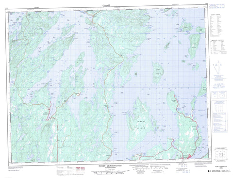
002E06 Point Leamington Canada topo map, 1:50,000 scale
002E06 Point Leamington NRCAN topographic map.
Includes UTM and GPS geographic coordinates (latitude and longitude). This 50k scale map is suitable for hiking, camping, and exploring, or you could frame it as a wall map.
Printed on-demand using high resolution, on heavy weight and acid free paper, or as an upgrade on a variety of synthetic materials.
Topos available on paper, Waterproof, Poly, or Tyvek. Usually shipping rolled, unless combined with other folded maps in one order.
- Product Number: NRCAN-002E06
- Parent Topo: TOPO-002E
- Map ID also known as: 002E06, 02E6, 2E6, 02E06, 2E06
- Unfolded Size: Approximately 26" high by 36" wide
- Weight (paper map): ca. 55 grams
- Map Type: POD NRCAN Topographic Map
- Map Scale: 1:50,000
- Geographical region: Newfoundland and Labrador, Canada
Neighboring Maps:
All neighboring Canadian topo maps are available for sale online at 1:50,000 scale.
Purchase the smaller scale map covering this area: Topo-002E
Spatial coverage:
Topo map sheet 002E06 Point Leamington covers the following places:
- Askel Cove - Babies Cove - Baptist Cove - Bard Island Cove - Barrow Cove - Bay of Exploits - Bay Point Cove - Beaver Brook Cove - Besom Cove - Big Cove - Boat Harbour - Bobs Cove - Brets Cove - Brook Harbour - Browns Arm - Budgell Harbour - Burnt Bay - Butler Cove - Cabbage Harbour - Charles Arm - Cold Harbour - Cooks Cove - Cooks Cove - Cottrells Cove - Cumlins Cove - Cutnows Cove - Foulke Cove - Fox Cove - Framptons Cove - Gain Cove - Glovers Harbour - Govers Harbour - Great Muddy Hole - Green Island Cove - Gull Cove - Harvey's Cove - Hoskins Harbour - Indian Cove - Indian Cove - Jeffries Cove - Jobs Cove - Joe's Cove - Lannings Cove - Lawrence Harbour - Little Arm East - Little Arm West - Little Burnt Bay - Little Indian Cove - Little Muddy Hole - Little North Harbour - Little Northwest Arm - Man of War Cove - Masons Cove - Mill Cove - Milord Arm - Moore's Cove - Mouse Cove - North Harbour - Northwest Bottom - Osmonton Arm - Paradise Cove - Pidwell Cove - Point Leamington Harbour - Porters Cove - Powderhouse Cove - Purbeck Cove - Randells Cove - Randells Cove - Rendells Cove - Ritters Arm - Salt Pond Cove - Sand Cove - Sandy Cove - Saunders Cove - Sharrons Cove - Shoal Cove - South Arm - Southeast Arm - Southern Head Cove - Southwest Arm - Southwest Bottom - Squid Cove - St. John's Bay - St. John's Harbour - Stanhope Cove - Stocking Harbour - Strong Island Sound - Swan Island Harbour - Tea Arm - Thwart Island Harbour - Twisty Ann's Cove - Ward Cove - West Arm - Whitehorn Cove - Wigwam Cove - Wild Bight - Wild Bight - Laceys Beach - Bay Point - Bills Point - Birchy Head - Brimstone Head - Cabbage Harbour Head - Cumlins Head - Dock Point - Glovers Point - Govers Point - Indian Point - Island Point - Jims Head - Lawrence Head - Leamington Point - Little Northwest Arm Head - Long Point - Mill Point - Muddy Hole Point - North Harbour Head - Pleasant Point - Rice Head - Shoal Tickle Point - Southeast Arm Point - Southern Head - Tea Point - Thimble Tickle Head - Ward Head - Wigwam Point - Yates Point - Chrises Gut - Hornet Gut - Main Channel - Shoal Tickle - Southern Passage - Winter Tickle - Beach Island - Berry Island - Besom Island - Big Bay Island - Big Island - Big Island - Birchy Island - Blackberry Island - Burnt Island - Burnt Island - Cat Island - Cull Island - Cuttle Island - Duck Islands - East Hare Island - Freak Island - Frying Pan Island - Gillet Island - Goat Island - Goat Islands - Granfer Island - Grassy Island - Grassy Island - Green Island - Green Island - Gull Island - High Grego Island - Hornet Island - Hummock Island - Indian Cove Island - James Island - Jobs Island - Lacey Island - Little Berry Island - Little Grego Island - Lobster Island - Long Island - Long Island - Mouse Island - Mouse Island - Mussel Bed Island - Mussel Island - Ochre Pit Island - Pigeon Island - Pigeon Islands - Pond Island - Red Currant Island - Rice Island - Rudder Island - Sailor Island - Spruce Islands - Strong Island - Sunday Island - Swan Island - Swan Islands - Thomas Rowsell Island - Thwart Island - Tinker Island - Tinker Island - Upper Black Island - Upper Duck Island - Ward Island - West Hare Island - Woody Island - Yellow Fox Island - Askel Lake - Askel Pond - Babies Cove Pond - Bard Island Pond - Bard Pond - Barr'd Pond - Big Lake - Big Otter Pond - Big Twins Ponds - Bobbies Pond - Bog Dam Pond - Budgell Pond - Burnt Pond - Cleaves Lake - Cooks Pond - Daws Pond - Diver Pond - Fall Pond - Fall Pond - Four Mile Lake - Grassy Pond - Grassy Pond - Island Pond - Laceys Pond - Lewis Lake - Line Pond - Little Arm Pond - Little Martin Lake - Little Pond - Long Pond - Long Pond - Martin Lake - Matties Pond - Middle Pond - Mill Pond - Mill Pond - Mill Pond - Mine Pond - Mud Lake - Nanny Bag Lake - Otter Pond - Pine Pond - Rocky Pond - Saltwater Pond - Sharrons Pond - Side Pond - Side Pond - Southern Lake - Squid Pond - Stowaway Pond - Twin Pond - Twin Ponds - Winter Tickle Lake - Nanny Bag Hill - Rowsells Hill - Charles Brook - Matties Brook - New Bay River - Two Mile Brook - West Arm Brook - Thimble Tickles - Gull Rock - Long Rock - Man of War Rock - Passage Rocks - Seal Rock - Embree - Leading Tickles - Leading Tickles West - Little Burnt Bay - Point Leamington - Point of Bay - Brown's Arm - Brown's Arm-Porterville - Bulley's Cove - Charles Brook - Cottrell's Cove - Cull Island - Glovers Harbour - Glover's Harbour - Leading Tickles - Leading Tickles East - Leading Tickles South - Masons Cove - Pleasantview - Porterville - Salt Pond Cove - Southeast Arm - Stanhope - Paradise


