
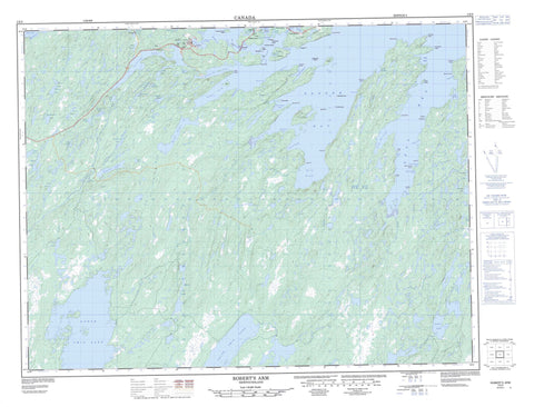
002E05 Robert s Arm Canada topo map, 1:50,000 scale
002E05 Robert s Arm NRCAN topographic map.
Includes UTM and GPS geographic coordinates (latitude and longitude). This 50k scale map is suitable for hiking, camping, and exploring, or you could frame it as a wall map.
Printed on-demand using high resolution, on heavy weight and acid free paper, or as an upgrade on a variety of synthetic materials.
Topos available on paper, Waterproof, Poly, or Tyvek. Usually shipping rolled, unless combined with other folded maps in one order.
- Product Number: NRCAN-002E05
- Parent Topo: TOPO-002E
- Map ID also known as: 002E05, 02E5, 2E5, 02E05, 2E05
- Unfolded Size: Approximately 26" high by 36" wide
- Weight (paper map): ca. 55 grams
- Map Type: POD NRCAN Topographic Map
- Map Scale: 1:50,000
- Geographical region: Newfoundland and Labrador, Canada
Neighboring Maps:
All neighboring Canadian topo maps are available for sale online at 1:50,000 scale.
Purchase the smaller scale map covering this area: Topo-002E
Spatial coverage:
Topo map sheet 002E05 Robert s Arm covers the following places:
- Badger Bay - Bear Cove - Beaver Bight - Big Cove - Birchy Cove - Bird Island Cove - Black Duck Cove - Burton's Harbour - Guys Cove - Halls Bay - Hammer Cove - Head Harbour - Herring Cove - Husseys Cove - Indian Cove - Jims Cove - Julies Harbour - Kelly Cove - Kettle Cove - Little Cove - Little Harbour - Locks Cove - Locks Harbour - Locks Harbour - Lower Sparrow Cove - Mansfield Cove - Measles Cove - Mill Cove - Penns Cove - Pretty Island Harbour - Robert's Arm - Seal Bay - Shoal Arm - Side Harbour - Sops Arm - Tilley Cove - Tommy's Arm - Upper Sparrow Cove - Wild Bight - Wild Bight - Bluff Point - Burton's Head - Cannon Head - Corner Point - Green Point - Hook Point - Inner Seal Head - Kelly Head - Nose Point - Omega Point - Raft Head - Ragged Point - Salmon Point - Seal Bay Head - Servier Point - Sops Head - Sparrow Cove Point - Thimble Head - Tilley Head - White Point - White Point - Woody Point - Flat Rock Tickle - Pilley's Tickle - Pretty Tickle - Raft Tickle - Bridges Island - Double Island - Duck Island - Fox Island - Goat Island - Gull Island - Gull Island - Harbour Island - Haywards Gull Island - Kay Island - Margesson Island - Picnic Island - Pretty Island - Raft Island - Sugarloaf Island - The Brandies - Turtle Island - Anthony Pond - Bologna Pond - Boot Harbour (Second) Pond - Boot Harbour First Pond - Camp Pond - Clearys Pond - Crescent Lake - Deer Pond - Extremity Pond - Fawn Pond - Ferry Pond - Fifields Pond - First Beaver Pond - First Pond - Five Island Pond - Flat Rock Pond - Fourth Pond - Fox Pond - Ghost Pond - Goose Pond - Grave Pond - Gummy Pond - Hammer Cove Pond - Horse Feeder Pond - Husseys Cove Pond - Indian Arm Pond - Island Pond - Joes Ponds - Julies Harbour Pond - Kippins Pond - Lewis Lake - Little Beaver Pond - Little Sandy Pond - Loadabats Pond - Long Lake - Looking Glass Pond - Marks Lake - Martin Pond - Middle Beaver Pond - Mud Pond - Muskrat Steady - Nipper Cove Pond - North Twin Lake - Robert's Arm Pond - Rocky Pond - Rowsells Pond - Rushy Pond - Sandy Pond - Second Pond - Shoal Arm Pond - Side Pond - Ski Pond - Sops Lake - South Twin Lake - South West Pond - Southern Lake - Spot Pond - Spruce Pond - Third Pond - Three Island Pond - Tommy's Arm Long Pond - Triton Pond - Trout Pond - Badger Bay Brook - Black Brook - Boot Harbour Brook - Five Island Pond Brook - Gummy Brook - Island Pond Brook - Pennys Brook - Seal Bay Brook - Shoal Arm Brook - Silver Brook - Sops Arm Brook - South Brook - Tommy's Arm River - Wellmans Brook - Wells Brook - West Arm Brook - Bar Rock - Buzzard Shoal - Callaghans Ground - Flat Rock - Fox Shoal - Georgies Rock - Hogs Nose Rocks - Ledrew Rock - Reynolds Shoal - Robert's Arm - Head Harbour - Lockport - Locks Harbour - Locks Harbour


