
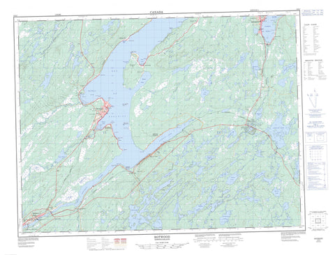
002E03 Botwood Canada topo map, 1:50,000 scale
002E03 Botwood NRCAN topographic map.
Includes UTM and GPS geographic coordinates (latitude and longitude). This 50k scale map is suitable for hiking, camping, and exploring, or you could frame it as a wall map.
Printed on-demand using high resolution, on heavy weight and acid free paper, or as an upgrade on a variety of synthetic materials.
Topos available on paper, Waterproof, Poly, or Tyvek. Usually shipping rolled, unless combined with other folded maps in one order.
- Product Number: NRCAN-002E03
- Parent Topo: TOPO-002E
- Map ID also known as: 002E03, 02E3, 2E3, 02E03, 2E03
- Unfolded Size: Approximately 26" high by 36" wide
- Weight (paper map): ca. 55 grams
- Map Type: POD NRCAN Topographic Map
- Map Scale: 1:50,000
- Geographical region: Newfoundland and Labrador, Canada
Neighboring Maps:
All neighboring Canadian topo maps are available for sale online at 1:50,000 scale.
Purchase the smaller scale map covering this area: Topo-002E
Spatial coverage:
Topo map sheet 002E03 Botwood covers the following places:
- Bay of Exploits - Burnt Arm - Burnt Bay - Jesse Cove - Joe's Cove - Kite Cove - Lewisporte Harbour - Norris Arm - Northern Arm - Peters Arm - Phillips Cove - Winter House Cove - Beatons Point - Cains Point - Evans Point - Gills Point - High Point - High Point - Killick Point - Little Peter Point - Lower Sandy Point - Melvins Point - Mill Point - Northern Arm Point - Old Wharf - Phillips Head - Shoal Point - Upper Sandy Point - Wigwam Point - Wiseman Head - Crow Cliff - Red Cliff - All in the Way Island - Right in the Road Island - Amy's Lake - Bear Lake - Beatty Lake - Big Eel Lake - Bradbury Lake - Burnt Bay Lake - Collins Lake - Conaway Lake - Dougal Lane Pond - Grants Lake - Island Pond - Junction Lake - Junction Pond - Lewis Lake - Lily Pond - Little Eel Lake - Mill Lake - Munroes Pond - O'Brien Lake - Peters Pond - Phillips Lake - Rattling Lake - Scawett Pond - Shirley Lake - Southwest Pond - Sun Pond - Sylt Lake - Templeman Lake - Upper Scissors Pond - The Kings Ridge - Whetstone Hill - Newfoundland T'Railway Provincial Park - Notre Dame Provincial Park - Charles Brook - Eel Brook - Exploits River - Indian Arm Brook - Jumpers Brook - Junction Pond Brook - Muddy Hole Brook - New Bay River - Northern Arm Brook - Peters River - Rattling Brook - Southwest Brook - Bishop's Falls - Botwood - Lewisporte - Norris Arm - Northern Arm - Peterview - Alderburn - Bishops Falls South - Brown's Arm-Porterville - Burnt Arm - Jumpers Brook - Laurenceton - Norris Arm North - North Side Norris Arm - Notre Dame Junction - Phillips Head - Rattling Brook - Sandy Point - South Side - The Barrens


