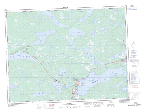
002D16 Gambo Canada topo map, 1:50,000 scale
002D16 Gambo NRCAN topographic map.
Includes UTM and GPS geographic coordinates (latitude and longitude). This 50k scale map is suitable for hiking, camping, and exploring, or you could frame it as a wall map.
Printed on-demand using high resolution, on heavy weight and acid free paper, or as an upgrade on a variety of synthetic materials.
Topos available on paper, Waterproof, Poly, or Tyvek. Usually shipping rolled, unless combined with other folded maps in one order.
- Product Number: NRCAN-002D16
- Parent Topo: TOPO-002D
- Map ID also known as: 002D16, 02D16, 2D16
- Unfolded Size: Approximately 26" high by 36" wide
- Weight (paper map): ca. 55 grams
- Map Type: POD NRCAN Topographic Map
- Map Scale: 1:50,000
- Geographical region: Newfoundland and Labrador, Canada
Neighboring Maps:
All neighboring Canadian topo maps are available for sale online at 1:50,000 scale.
Purchase the smaller scale map covering this area: Topo-002D
Spatial coverage:
Topo map sheet 002D16 Gambo covers the following places:
- Abe Keans Cove - Boom Cove - Boutcher's Cove - Browns Bottom - Camp Cove - Cat Bay - Clay Cove - Deep Cove - Doctors Cove - Fish Cove - Flat Cove - Franks Cove - Freshwater Bay - Ghosts Cove - Gords Cove - Hare Bay - Hatchet Cove - Hay Cove - Houses Cove - Johnny Moores Den - Johnny Moores Den (Cove) - Little Park - Lockers Bay - Lower Dark Cove - Mill Cove - Parkers Cove - Pissimere - Pissimere (Cove) - Ship Millers Dock - Ship Millers Dock (Cove) - Southwest Bottom - The Bight - Troublesome Cove - Upper Dark Cove - Wisemans Bottom - Brown Beach - Butchers Beach - Apple Point - Burnt Point - Deals Point - Dollomans Point - Green Point - Hatchet Head - Marsh Point - Mesh Point - Pickers Point - Tower Point - Benmans Tickle - Cat Gut - Ballast Cliff - The Chute - Air Island - Bard Island - Benmans Island - Benman's Island - Doctor's Island - Gull Island - Hen Islands - Long Island - Southwest Island - Traverse Brook Island - Traverse Gull Island - Traverse Island - Traverse Island - Woody Island - Beaver Pond - Belvies Waters - Big Bees Pond - Black Duck Pond - Bluff Head Pond - Bobcat Pond - Boot Pond - Butts Pond - Camp 30 Pond - Cat Bay Pond - Charlie Barrows Pond - Cliff Brook Big Pond - Cook's Pond - Dannys Ponds - Dark Cove Pond - Dark Cove Pond - Fifth Pond - First Burnt Pond - First Burnt Pond - First Pond - First Traverse Pond - Flanders Steady - Fourth Pond - Fox Pond - Gander Lake - Garys Steady - Goodyears Pond - Goose Pond - Granfers Steadies - Gull Pond - Hare Bay Pond - Home Pond - Horse-Stinger Steady - Island Pond - Jessy Pond - Jims Pond - Joes Pond - John Collins Pond - Johns Steady - Lees Pond - Little Butts Pond - Little Pond - Little Wing Pond - Lockers Bay Steady - Long Pond - Long Steady - Madelines Pond - Muddy Pond - One Mile Pond - Parkers Pond - Petes Pond - Powderhorn Steady - Puncheon Pond - Puncheon Pond - Pussels Pond - Rocky Pond - Round Pond - Round Pond - Round Pond - Round Ponds - Russell Pond - Sammys Steadies - Second Brook Steady - Second Burnt Pond - Second Burnt Pond - Second Pond - Second Southwest Pond - Second Traverse Pond - Sixth Pond - Soulis Pond - Southwest Pond - Southwest Pond - Southwest Steady - Square Pond - Third Pond - Three Mile Pond - Tobins Pond - Traverse Pond - Treasures Pond - Two Mile Pond - West Tower Pond - Wing Pond - Wisemans Steady - Crown Ridge - Drovers Ridge - Five Mile Ridge - Gambo Ridge - Rocky Route - Rocky Route (Hill) - Scurvy Ridge - The Nuddick - Twenty Five Ridge - David Smallwood Provincial Park - Newfoundland T'Railway Provincial Park - Smallwood (Middle Brook Falls) Provincial Park - Square Pond Provincial Park - Beaver Brook - Black Duck Brook - Burnt Brook - Burnt Pond Brook - Cooks Brook - Flanders Brook - Gambo Brook - Grammars Brook - Granfers Brook - Gull Pond Brook - Jimmy Henders Brook - Joe's Brook - Lockers Bay Brook - Man-Made Brook - Middle Brook - Muddy Brook - Muddy Brook - Northwest Brook - Northwest Brook - Otter Brook - Pussels Brook - Second Brook - Second Burnt Pond Brook - Soulis Brook - Southwest Brook - Traverse Brook - Trench Brook - Tunnel Brook - West Tower Brook - West Tower River - Content Reach - Dark Cove-Middle Brook-Gambo - Gambo - Hare Bay - Benton - Butts - Gambo - Gambo South - Middle Brook - Middle Brook South - Pritchetts - Bees Bog - Bemisters Bog - Brown Bog - Granmars Bog - Harts Bog - High Marsh - High Marsh - Jobs Bog - Lees Bog - Strouds Bog


