
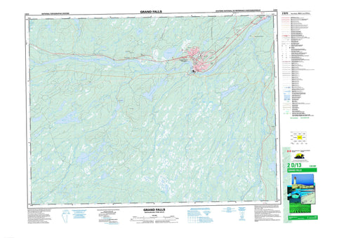
002D13 Grand Falls Canada topo map, 1:50,000 scale
002D13 Grand Falls NRCAN topographic map.
Includes UTM and GPS geographic coordinates (latitude and longitude). This 50k scale map is suitable for hiking, camping, and exploring, or you could frame it as a wall map.
Printed on-demand using high resolution, on heavy weight and acid free paper, or as an upgrade on a variety of synthetic materials.
Topos available on paper, Waterproof, Poly, or Tyvek. Usually shipping rolled, unless combined with other folded maps in one order.
- Product Number: NRCAN-002D13
- Parent Topo: TOPO-002D
- Map ID also known as: 002D13, 02D13, 2D13
- Unfolded Size: Approximately 26" high by 36" wide
- Weight (paper map): ca. 55 grams
- Map Type: POD NRCAN Topographic Map
- Map Scale: 1:50,000
- Geographical region: Newfoundland and Labrador, Canada
Neighboring Maps:
All neighboring Canadian topo maps are available for sale online at 1:50,000 scale.
Purchase the smaller scale map covering this area: Topo-002D
Spatial coverage:
Topo map sheet 002D13 Grand Falls covers the following places:
- Grand Falls - Aspen Pond - Big Rocky Pond - Cassandra Pond - Diversion Lake - French Pond - Island Pond - Leech Pond - Lemotte's Lake - Little Rattling Lake - Little Rocky Pond - Moccasin Lake - Rushy Pond - Rushy Pond - Seacat Pond - West Lake - Tote Hill - Aspen Brook Provincial Park - Beothuck Provincial Park - Newfoundland T'Railway Provincial Park - Aspen Brook - Caledonia Brook - Clipper Brook - Corduroy Brook - Coronation Brook - Crooked Knife Brook - Dog Brook - Exploits River - Frenchman's Brook - Great Rattling Brook - Green Woods Brook - Junction Brook - Langsdowns Brook - Leech Brook - Little Junction Brook - Little Rattling Brook - Middle Brook - Peters River - Pynn's Brook - Sandy Brook - Small Brook - Stony Brook - Three Brooks - Thunder Brook - Tom Joe Brook - Tote River - West Brook - West Stony Brook - Wigwam Brook - Bishop's Falls - Grand Falls-Windsor - Cruisers - Grand Falls - Grenfell Heights - Rattling Brook Depot - Red Cliff - Rushy Pond - Windsor


