
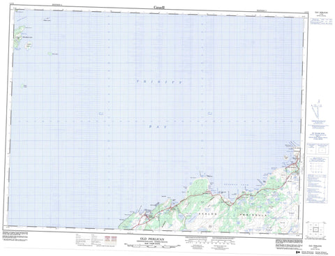
002C03 Old Perlican Canada topo map, 1:50,000 scale
002C03 Old Perlican NRCAN topographic map.
Includes UTM and GPS geographic coordinates (latitude and longitude). This 50k scale map is suitable for hiking, camping, and exploring, or you could frame it as a wall map.
Printed on-demand using high resolution, on heavy weight and acid free paper, or as an upgrade on a variety of synthetic materials.
Topos available on paper, Waterproof, Poly, or Tyvek. Usually shipping rolled, unless combined with other folded maps in one order.
- Product Number: NRCAN-002C03
- Parent Topo: TOPO-002C
- Map ID also known as: 002C03, 02C3, 2C3, 02C03, 2C03
- Unfolded Size: Approximately 26" high by 36" wide
- Weight (paper map): ca. 55 grams
- Map Type: POD NRCAN Topographic Map
- Map Scale: 1:50,000
- Geographical region: Newfoundland and Labrador, Canada
Neighboring Maps:
All neighboring Canadian topo maps are available for sale online at 1:50,000 scale.
Purchase the smaller scale map covering this area: Topo-002C
Spatial coverage:
Topo map sheet 002C03 Old Perlican covers the following places:
- Back Cove - Besom Cove - Big Brook Cove - Brook Cove - Brownsdale Cove - Bull Gulch - Bullocks Gulch - Burn Cove - Caplin Cove - Cooks Cove - Crab Cove - Elijah Cove - Greene Cove - Hants Harbour - Ireland's Eye Harbour - Island Point Cove - Jacobs Cove - Lead Cove - Long Gulch - Maids Brook Cove - Mizzen Cove - Mount Fagner Cove - New Chelsea Cove - Old Perlican Cove - Russels Cove - Sibleys Cove - Skerwink Cove - Smith Sound - Swimming Gulch - Trinity Bay - War Head Cove - Goods Beach - Abrahams Head - Avalon Peninsula - Barbours Head - Bay de Verde Peninsula - Besom Point - British Harbour Point - Bull Gulch Point - Burseys Point - Caplin Cove Head - Chelsea Head - Custers Head - East of Brownsdale - Easter Point - Hant's Head - Ireland's Eye Point - Island Point - Lower Island Point - Mansfield Point - Middle Head - Mizzen Point - Mount Fagner Head - Pancake Head - Salvage Point - Seal Point - Skerwink Point - Taylor Point - Upper Island Point - War Head - West of Brownsdale - Wester Head - White Point - Anthony Island - Brandies - Duck Island - Georges Island - Grassy Isle - Green Island - Ireland's Eye - Little Islands - Offer Island - Perlican Island - Pigeon Island - Ragged Island - Ragged Islands - Shag Islands - Spear Head Island - Tickle Island - Bell Pond - Besom Cove Pond - Big Brook Pond - Big Brook Steady - Big Steadies - Black Duck Pond - Black Duck Pond - Boar Pond - Burnt Point Steady - Charlies Ponds - Church Pond - Church Pond - Dabblers Pond - Five Mile Pond - Five Mile Pond Lower Gully - Five Mile Pond Upper Gully - Gull Pond - Gull Pond - Iron Box Pond - Island Pond - Island Pond - Kings Head Pond - Lance Cove Pond - Lance Cove Pond - Lily Pond - Little Bell Pond - Little Island Pond - Long Boar Pond - Long Pond - Maids Pond - Mares Pond - Middle Pond - Mount Fagner Pond - Pitmans Pond - Seal Cove Pond - Shorts Pond - Sibleys Cove Pond - Sibleys Cove Small Pond - Simmons Pond - Small Steadies - Sow Pond - The Gullies - Three Corner Gully - Trout Pond - Whales Brook Pond - Adams Lookout - Berrypicking Hill - Big Hill - Diamond Hill - Gaze Hill - Huts Hill - Miners Hills - Mount Fagner - Nuddick - Pattys Hill - Southside Hill - Sugar Rock Hill - The Tolt - Twelve O'Clock Hill - Besom Cove Brook - Big Brook - Big Brook - Black Duck Pond Brook - Brown Brook - Burnt Wood Brook - Great Brook - Maids Brook - Mount Fagner Brook - Sibleys Cove Brook - Southwest Brook - The Brook - Whales Brook - Arthur Rock - Big Rock - Black Ledge - Darby Ledge - Friday Ledge - Green Ledge - Gunner Rock - Hants Harbour Rock - Harbour Rock - Hodder Rock - Ice Ledge - Knife Rock - Middle Head Rock - Moses Reed Rock - New Ledge - Ragged Rock - Riff Raff Rocks - Salvage Rock - Salvage Rocks - Seal Rocks - Skerries - Skerwink Rock - Swile Cove Rock - Tail of the Bank - The Flats - Tilleys Path End - White Rocks - Hant's Harbour - Old Perlican - Brownsdale - Ireland's Eye - Lead Cove - New Chelsea - New Chelsea-New Melbourne-Brownsdale-Sibley's Cove-Lead Cove - New Melbourne - New Melbourne-Brownsdale-Sibley's Cove-Lead Cove - Sibleys Cove - Bull Gulch - Berrymarsh - Five Mile Pond Marshes - Frog Marsh - Lance Cove Pond Marsh - Perlican Barrens


