
002C02 Bay De Verde Canada topo map, 1:50,000 scale
002C02 Bay De Verde NRCAN topographic map.
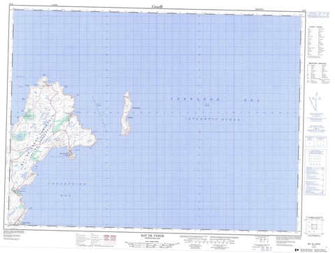
Includes UTM and GPS geographic coordinates (latitude and longitude). This 50k scale map is suitable for hiking, camping, and exploring, or you could frame it as a wall map.
Printed on-demand using high resolution, on heavy weight and acid free paper, or as an upgrade on a variety of synthetic materials.
Topos available on paper, Waterproof, Poly, or Tyvek. Usually shipping rolled, unless combined with other folded maps in one order.
- Product Number: NRCAN-002C02
- Parent Topo: TOPO-002C
- Map ID also known as: 002C02, 02C2, 2C2, 02C02, 2C02
- Unfolded Size: Approximately 26" high by 36" wide
- Weight (paper map): ca. 55 grams
- Map Type: POD NRCAN Topographic Map
- Map Scale: 1:50,000
- Geographical region: Newfoundland and Labrador, Canada
Neighboring Maps:
All neighboring Canadian topo maps are available for sale online at 1:50,000 scale.
Purchase the smaller scale map covering this area: Topo-002C
Spatial coverage:
Topo map sheet 002C02 Bay De Verde covers the following places:
- Backside - Bay de Verde - Bay de Verde Harbour - Big Gulch - Biscan Cove - Biscan Cove - Blackhead Bight - Blowin Hole - Broom Cove - Butter Gulch - Caplin Cove - Careys Hole - Churchill Gulch - Conception Bay - Cooks Cove - Coopers Cove - Council Cove - Daniels Cove - Flambro Head Cove - Friday Cove - Gormans Cove - Grannys Hole - Grates Cove - Greenland Anchor - Gun Cove - Heart Cove - Herring Gulch - Horn Cove - Horsefire Cove - Jacksons Gulch - Jacksons Gulch - Joeys Cove - Jonathans Hole - Kettle Cove - Kit Gulch - London Gulch - Long Gulch - Low Point Cove - Middle Head Cove - Motion - Mussel Bank Cove - Ned Walshs Cove - North Motion - Norther End Gulch - Oil Gulch - Pigeon Gulch - Pinch Gut Isle Bight - Red Head Cove - Reubens Gulch - Round Cove - Scotch Hole Gulch - Sheas Gulch - Shell Point Cove - Ship Cove - Souther End Cove - Split Point Cove - Spout Cove - Stair Cove - Stouter Gulch - Strouter Gulch - Swiles Cove - Tansy - The Bight - The Gulch - Tidy Cove - Trinity Bay - Wester Point Bight - Woody Cove - Church Holes - Flambro Head Beach - Flambro Head Holes - Little Beach - Staffords Gulch - Whalens Place - Avalon Peninsula - Bay de Verde Head - Bay de Verde Peninsula - Big Sheeps Head - Black Point - Bloody Point - Blundons Point - Bonanza - Bonnie Point - Breakheart Point - Bristol - Broom Point - Buggedys Point - Cahills Point - Church Point - Dunn Island - Flambro Head - Flat Rock Point - Goldmine Head - Grates Point - Green Point - Hornes Point - Horns Point - John Millers Island - Kettle Cove Point - Kimbers Head - Kings Head - Little Sheeps Head - Low Point - Martins Island - Middle Head - Mizzen - Morn Point - Mouldy Point - Naked Man - Neddies Point - Nepean Point - Norther End - Puzzling Point - Ragged Point - Red Head - Red Head - Red Head - Sailing Point - Salmon Point - Sean Point - Shell Point - Southeast Point - Souther End - Split Point - Swile Cove Point - The Head - Timbers Head - Wales Point - Walshs Island - Watton Head - Wester Point - Baccalieu Tickle - Dog Path - Blue Cliff - Clip Boney - Cow Path - Croucher - Falmouth - Flambro Head Bill - Gannet - Greenwoods - Red Cliff - Baccalieu Island - Pinch Gut Isle - Puffin Island - Sgeir Island - Beaver Pond - Billy Emberleys Pond - Birchy Pond - Black Duck Pond - Black Duck Pond - Blundon Pond - Blundon Small Pond - Breeches Pond - Bristy Cove Pond - Clear Pond - Cooks Pond - Cotters Pond - Cotters Pond - Cramm Point Pond - Culligans Pond - Daniels Cove Long Pond - Daniels Cove Pond - Flemmings Pond - Form Pond - Grates Cove Pond - Gull Pond - Heart Pond - Island Pond - Lamberts Pond - Little Pond - London Pond - Long Pond - Long Pond - Marchs Pond - Martins Pond - Monday Pond - Mother Tizzards Pond - New Trout Pond - Rocky Pond - Rocky Pond - Rodgers Pond - Sherwood Pond - Souther End Pond - Tickle Pond - Trout Pond - Tuesday Pond - Big Hill - Drodges Hill - Gormans Hill - Horn Highlands - John Busseys Hill - Lowlands - Mason Hill - Middle Ridge - Norris Hill - The Lookout - Twelve O'Clock Hill - Whorts Hill - Baccalieu Island Ecological Reserve - Bunny Brook - Burnt Wood Brook - Cooks Cove Pond Brook - Spout Cove Brook - Stringer Brook - The Brook - Ball and Scrape - Cats Ears - Collins Ledge - Fish Rock - Grates Rock - Inner Collins Ledge - Island Rock - Jewish Rock - Martins Ledge - Tickle Rock - Wall Rock - Whale Back - Bay de Verde - Old Perlican - Baccalieu Island - Caplin Cove - Daniel's Cove - Grates Cove - Low Point - Lower Island Cove - Red Head Cove - Flat Rock Valley - New Drook - Bugbies Marsh - Devils Dancing Place - Feather Bed - Heart Barrens - Monday Pond Marsh - Red Head Pond - The Plain


