
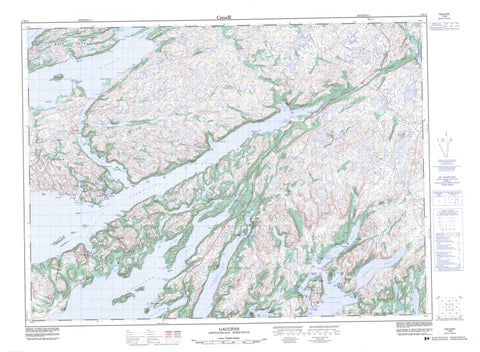
001M12 Gaultois Canada topo map, 1:50,000 scale
001M12 Gaultois NRCAN topographic map.
Includes UTM and GPS geographic coordinates (latitude and longitude). This 50k scale map is suitable for hiking, camping, and exploring, or you could frame it as a wall map.
Printed on-demand using high resolution, on heavy weight and acid free paper, or as an upgrade on a variety of synthetic materials.
Topos available on paper, Waterproof, Poly, or Tyvek. Usually shipping rolled, unless combined with other folded maps in one order.
- Product Number: NRCAN-001M12
- Parent Topo: TOPO-001M
- Map ID also known as: 001M12, 01M12, 1M12
- Unfolded Size: Approximately 26" high by 36" wide
- Weight (paper map): ca. 55 grams
- Map Type: POD NRCAN Topographic Map
- Map Scale: 1:50,000
- Geographical region: Newfoundland and Labrador, Canada
Neighboring Maps:
All neighboring Canadian topo maps are available for sale online at 1:50,000 scale.
Purchase the smaller scale map covering this area: Topo-001M
Spatial coverage:
Topo map sheet 001M12 Gaultois covers the following places:
- Back Cove - Back Cove - Bald Cove - Baldens Cove - Barasway Harbour - Bay d'Espoir - Big Brook Cove - Big Sandy Cove - Bill Skinners Cove - Billy Skinners Cove - Black Duck Cove - Black Head Cove - Black Hole - Black Hole - Blackfish Cove - Bob White Cove - Bobby Herring Cove - Boldens Cove - Brimball Harbour - Broad Cove - Bubbles Cove - Buffet Cove - Bufford Cove - Cat Cove - Chaner Cove - Clay Cove - Cluett Bight - Coffee Cove - Cold Harbour - Connaigre Bay - Coopers Cove - Copper Cliff Cove - Cork Cove - Cox's Cove - Cuff Cove - Curley Cove - Dawson's Cove - Day Cove - Deep Bight - Deep Cove - Deer Cove - Dog Cove - Dolland Bight - Doting Hole - Eastern Bottom - Eastern Bottom Cove - Eastern Cove - Eastern Cove - Eastern Cove - Eastern Cove - Eastern Kings Cove - Eastern Rinding Cove - Ernest Hills Cove - Fish Cove - Flake Cove - Fly Away - Fox Cove - Friar Cove - Frostbite Cove - Furby's Cove - Gaultois Harbour - Grassy Cove - Great Bay de l'Eau - Great Harbour - Great Harbour Bight - Grip Cove - Handy Cove - Harbour Breton - Harbour le Gallais - Hardy Cove - Hardy's Cove - Harvey Cove - Hatcher Cove - Hatchet Cove - Hermitage Bay - Hermitage Cove - Herring Cove - Hughies Cove - Island Cove - Jerseyman's Harbour - Jim Green Cove - Kays Hole - Kearleys Cove - Kendells Cove - Kings Cove - Kippins Harbour - Krant Bight - Landing Cove - L'Anse à Flamme - Lilly's Cove - Little Bay - Longer Cove - Maria Cove - Matchems Cove - May Cove - McDonalds Cove - Merchant Cove - Michaels Cove - Middle Cove - Middle Head Cove - Mooring Cove - Muddy Hole - Nancys Cove - Nancys Hole - Northeast Arm - Northeast Arm Friar - Northwest Arm - Northwest Cove - Northwest Cove - Northwest Cove - Old Bay - Olive Cove - Partridge Cove - Patty Cove - Peters Cove - Piccaire Harbour - Pierceys Cove - Pigeon Hole - Pink Bottom - Potato Bed Cove - Red Cove - Robin Hood Cove - Round Cove - Rubbley Cove - Russells Cove - Salmonier Cove - Salmonier Cove - Salmonier Cove - Seal Cove - Seal Nest Cove - Shoal Cove - Shoal Cove - Shoal Cove - Snooks Harbour - Southeast Bight - Spirit Cove - Spruce Cove - Squires Cove - Stag Cove - Stickland Cove - Strouter Cove - Tan Pot (Cove) - Taylor Bay - Taylors Rocks Cove - The Bottom - The Locker - The Pocket - Thornhill Cove - Tickle Beach Cove - Tom Lees Cove - Western Cove - Western Cove - Western Kings Cove - Western Rinding Cove - Whetstone Cove - White Point Cove - Winter House Cove - Winter House Cove - Winter House Cove - Wreck Cove - Wreck Cove - Ambrose Head - Bald Point - Bald Point - Barrisway Point - Bay Point - Big Black Head - Big Brook Point - Big Head - Big Head - Big Head - Blow Me Down Head - Bobbit Point - Bobby Houses Point - Bobbys Point - Brem Point - Brimball Head - Buffet Point - Cape Mark - Collins Head - Connaigre Head - Cribbs Nose - Day Point - Deep Water Point - Deep Water Point - Deepwater Point - Deepwater Point - Deepwater Point - Dog Cove Head - Doughball Point - Downs Point - Eastern Head - First Otter Point - Fish Head - Fish Point - Flat Back Curve - Fox Burrow Point - Frenchman Head - Frenchman Head - Gimlet Point - Grassy Point - Green Point - Harry Soudens Head - Harry Youdens Head - Herring Net Point - Herring Net Point - Herring Point - High Head - Honeys Point - Hound Point - Indian Point - Indian Point - Iron Head - Island Head - Island Point - Jim McDonalds Point - Jimmy Houses Point - Krant Point - Land Point - Landing Point - Little Black Head - Little Copper Head - Long Point - Long Reach Point - Margery Head - Maria Cove Point - Matts Point - May Head - Middle Head - Miller Point - Mooring Cove Head - Mooring Cove Point - Muddy Hole Point - Murphy Point - Net Point - Net Point - Old Mans Point - Old Womans Cove Point - Passage Point - Peeping Point - Pig Point - Poor Bills Point - Raymond Point - Red Cove Head - Red Head - River Head - Round Cove Head - Russell Head - Salmon Point - Sandy Point - Sandy Point - Seal Rock Point - Second Otter Point - Shoal Cove Point - Shoal Point - Shoal Point - Simmonds Point - South Hay Point - Southeast Brook Point - Southern Sandy Point - Tell Cove Point - The Neck - Thornhill Point - Tickle Head - Tickle Point - Tilt Point - Tilting Cove Point - Tippers Point - Tom MacDonalds Point - Twaney Head - West Head - Western Point - White Point - White Point - Whalers Cave - Lampidoes Passage - Little Passage - Miller's Passage - The First Narrows - The Second Narrows - The Tickle - Fish Cliff - Greeps Nest - Harveys Cliff - Paint Cliff - Bois Island - Devils Island - Fox Island - Great Island - Hughies Island - Isle Galet - King Island - Lamy (Whale) Island - Little Devils Island - Little Fox Island - Little Island - Long Island - Middle Island - Taylor Island - The Matchems - Whale (Lamy) Island - Will Island - Barrisway - Big Pond - Country Path Pond - Eastern Ponds - Gull Pond - Gull Pond - Harbour Gallais Pond - Inside Pond - Long Pond - Long Reach Pond - Middle Pond - Northeast Barasway - Otter Pond - Salmonier Pond - Sawpit Pond - Simmonds Barasway - Snooks Harbour Pond - Southern Bight Steady - The Barasway - Western Gull Pond - White Point Pond - Winter House Pond - Withrod Pond - Burnt Ground - Crow Nest - Devils Knob - Garrison Hills - Harvey Hill - Mullins Hill - The Knob - The Level - The Park - Whales Back - Big Brook - Black Brook - Black Tom Brook - Bottom Brook - Bottom Brook - Broad Cove Brook - Cookroom Brook - Country Brook - Dry Brook - Eastern Brook - Garrison Hills Brook - Harrys Brook - Herring Net Brook - Juniors Brook - Middle Island Brook - Muskrat Brook - Northeast Brook - Northern Brook - Northwest Brook - Old Brook - Otter Brook - Rattling Brook - Rattling Brook - Rattling Brook - Salmon River - Sandy Brook - Shoal Brook - Simmons Brook - South East Brook - South West Brook - Southeast Brook - The Brook - The Brook - Trout Brook - Vallis Brook - Long Reach - Robert Kendells Path - Bald Rock - Bufford Rocks - Cannon Rock - Cats Claw - Cluett Rock - Connaigre Shoal - Crazy Betty - Devils Shoal - Fox Island Bank - Fox Island Rock - Goose Rock - Gull Rock - Gull Rock - Harbour Shoal - Kelly Rock - Kings Rocks - Mad Moll - Margery Rock - Miller Shoal - Parsons Rock - Poole Rock - Red Cove Rock - Robins Rock - Seal Island Rocks - Seal Rocks - Sloop Rock - Sunken Rocks - Taylor Island Rocks - Tell Rock - The Reef - The Rock - Virgin Rock - Yellow Rock - Gaultois - Hermitage - Hermitage-Sandyville - Barachoix - Dawson's Cove - Furby's Cove - Great Harbour - Hardy's Cove - Little Bay West - Miller's Passage - Piccaire - Raymond Point - Red Cove - Round Cove - Sandyville - Low Barren - Yellow Marsh


