
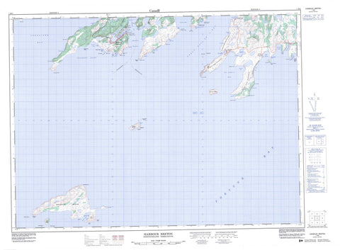
001M05 Harbour Breton Canada topo map, 1:50,000 scale
001M05 Harbour Breton NRCAN topographic map.
Includes UTM and GPS geographic coordinates (latitude and longitude). This 50k scale map is suitable for hiking, camping, and exploring, or you could frame it as a wall map.
Printed on-demand using high resolution, on heavy weight and acid free paper, or as an upgrade on a variety of synthetic materials.
Topos available on paper, Waterproof, Poly, or Tyvek. Usually shipping rolled, unless combined with other folded maps in one order.
- Product Number: NRCAN-001M05
- Parent Topo: TOPO-001M
- Map ID also known as: 001M05, 01M5, 1M5, 01M05, 1M05
- Unfolded Size: Approximately 26" high by 36" wide
- Weight (paper map): ca. 55 grams
- Map Type: POD NRCAN Topographic Map
- Map Scale: 1:50,000
- Geographical region: Newfoundland and Labrador, Canada
Neighboring Maps:
All neighboring Canadian topo maps are available for sale online at 1:50,000 scale.
Purchase the smaller scale map covering this area: Topo-001M
Spatial coverage:
Topo map sheet 001M05 Harbour Breton covers the following places:
- Barasway - Bear Cove - Bills Cove - Black Island Cove - Blanchard Cove - Blow Me Down Cove - Blunder Cove - Boxey Back Cove - Boxey Harbour - Brag Cove - Chappie Cove - Connaigre Bay - Coomb's Cove - Cutthroat - Deadmans Bight - Deadman's Bight - Eastern Cove - English Harbour Back Cove - English Harbour West - Fortune Bay - Fox Cove - Great Bay de l'Eau - Great Ma Jambe - Harbour Breton - Hatcher Cove - Herring Cove - Herring Cove - Jerseyman's Harbour - Little Bay - Little Ma Jambe - Lord and Lady Cove - Mercer Cove - Michael Day Cove - Northeast Arm - Old Room - Open Cove - Poole Cove - Saltwater Cove - Saltwater Cove - Saucepan Cove - Shepherd Cove - Southwest Arm - St. John's Bay - St. John's Harbour - Trimmings Cove - Uncle Bob Cove - Western Cove - White Point Cove - Wild Cove - Wreck Cove - Thompson Beach - Bacon Point - Ben Point - Bluff Head - Boxey Harbour Head - Boxey Point - Boxey Point Promontory - Brag Point - Brook Point - Bull Point - Connaigre Head - Crow Head - Dunphy Head - Eastern Head - Friar Head - Hunts Point - Jerseyman's Head - Little Bay Head - Little Bay Western Head - Little Cape - Major Point - Mercer Head - Middle Head - Northwest Head - Oxford Point - Pierceys Point - Point of the Beach - Red Head - Red Head - Rocky Point - Salmon Net Point - Saltwater Point - Sam Head - Shepherd Cove Eastern Head - Shepherd Cove Western Head - St. John's Head - St. John's Head Promontory - The Knob - Trap Point - Western Head - White Point - White Point - Woody Head - Bird Island - Black Island - Brunette Island - Duck Island - English Harbour Island - Green Island - Gull Island - Little Sagona Island - Puffin Island - Rabbit Island - Sagona Island - St. John's Island - Big Pond - Little Pond - Gun Hill - Northern Hills - Parsons Hill - The Tolt - Bottom Brook - Boxey Brook - Man of War Brook - Man O'War Brook - Otter Brook - Southwest Corner Brook - Bank O'North Shoal - Bank Shoal - Basse Terre Shoal - Bens Rock - Big Shoal - Big Shoal - Billy Rock - Black Cove Shoal - Black Island Rock - Blanchard Shoal - Blunder Shoal - Boxey Rock - Brandies Rocks - Brunet Shoal - Brunet Shoal - Brunnette Bank - Bull Shoal - Bungay Rock - Charlie Shoal - Cod Shoal - Connaigre Rock - Coral Shoal - Daniels Rock - Deer Shoal - Dumpling Shoal - Eastern Rock - Enoch Place - Fall off the Island - Father Skinner Shoal - Fish Rock - Fish Rock - Friar Rock - Gulch Shoal - Gull Rock - Hairy Man Shoal - Halibut Shoal - Harbour Mouth Shoal - Harbour Rock - Harbour Rock - Harbour Shoal - Head Shoal - Hell Hole Shoal - Inner Rock - Inner Rock - Inside Bank - Island Shoal - Job Rock - Joeys Rock - John Green Shoal - Johns Rock - Keeping Rock - Killick Ledge - Kippins Shoal - Knob Shoal - Little Bay Shoal - Lord and Lady Rock - Maddison Shoal - Mercer Rocks - Michael Day Shoal - Middle Rock - Net Shoal - Neverfail Shoal - No Name Shoal - North Big Shoal - North East Shoal - Northward Friar - Offer Rock - Old Man Place - Rock Shoal - Sagona Shoal - Salmon Shoal - Shag Island Sunker - Shag Rock - Shag Rock - Shag Rock - Shag Rock Bank - Shelf Rock - Shepherd Rock - Shoal Cove Rocks - Skate Shoal - Smooth Cove Rock - Southwest Point Shoal - Sunken Rock Shoal - Teddy Cove Shoal - The Friar - The Knob - The Rock - Tickle Cove Shoal - Tom Rock - Trawl Shoal - Uncle Toms New Shoal - Voile Rock - Western Bank - White Point Shoal - White Rock Shoal - Wolf Shoal - Woody Head Rocks - Harbour Breton - St. Jacques-Coomb's Cove - Blanchet - Boxey - Coomb's Cove - English Harbour West - Forward's Cove - Jersey Harbour - Mercer's Cove - Mose Ambrose - Sagona Island - St. John's Bay - Tibbos Hill - Wreck Cove


