
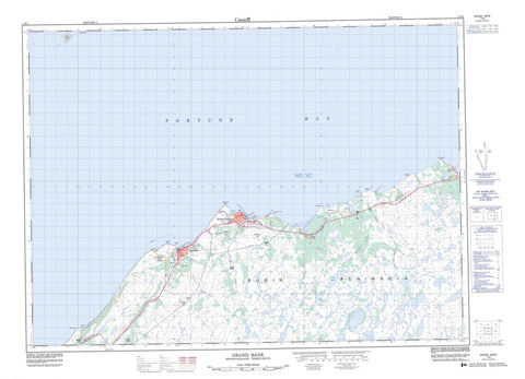
001M04 Grand Bank Canada topo map, 1:50,000 scale
001M04 Grand Bank NRCAN topographic map.
Includes UTM and GPS geographic coordinates (latitude and longitude). This 50k scale map is suitable for hiking, camping, and exploring, or you could frame it as a wall map.
Printed on-demand using high resolution, on heavy weight and acid free paper, or as an upgrade on a variety of synthetic materials.
Topos available on paper, Waterproof, Poly, or Tyvek. Usually shipping rolled, unless combined with other folded maps in one order.
- Product Number: NRCAN-001M04
- Parent Topo: TOPO-001M
- Map ID also known as: 001M04, 01M4, 1M4, 01M04, 1M04
- Unfolded Size: Approximately 26" high by 36" wide
- Weight (paper map): ca. 55 grams
- Map Type: POD NRCAN Topographic Map
- Map Scale: 1:50,000
- Geographical region: Newfoundland and Labrador, Canada
Neighboring Maps:
All neighboring Canadian topo maps are available for sale online at 1:50,000 scale.
Purchase the smaller scale map covering this area: Topo-001M
Spatial coverage:
Topo map sheet 001M04 Grand Bank covers the following places:
- Admiral Cove - Beach Cove - Bouy Place - Caplin Cove - Famine Back Cove - Fortune Bay - Grand Bank Harbour - Kellys Cove - L'Anse à Paul - L'Anse au Loup - Lee Beach - Molliers Cove - Muddy Hole - Naked Mans Cove - Peter Cove - The Bight - Straight Shore - Trimms Beach - Beach Point - Black Point - Bouilli Point - Burin Peninsula - Cross Point - Crouse Point - Evans Head - Famine Point - Fortune Head - Fox Hummocks - Grand Bank Head - Grand Beach Point - L'Anse au Loup Point - Lee Beach Point - Little Barasway Point - Long Point - Molliers Point - Schooner Point - The Cape - First Gulch - Fortune Gut - Grand Bank Gut - The Gut - Connors Woods - Southern Spot Woods - Bird Island - Puffin Island - Admiral Cove Pond - American Pond - Aunt Priscillas Ponds - Bar Pond - Bear Path Ponds - Big Gunville Pond - Black Duck Pond - Black Hill Woods Pond - Bulls Yard Pond - Burnt Hill Pond - Central Famine Ponds - Connors Woods Ponds - Country Pond - Cross Brook Pond - Crouse Barasway - Crouse Gull Pond - Crouse Pond - Dantzic Pond - Eastern Fork Famine Pond - Eastern Spell Pond - Famine Barasway - Famine Mowing Pond - Famine Pond - Famine Pond - Flahertys Pond - Forseys Pond - Fortune Barasway - Fresh Pond - Grand Bank Ponds - Grand Beach Barasway - Gull Pond - Gull Pond - Gunville Pond - Head Waters - Hill Of Birch Pond - Hunters Burnt Ground Pond - Inside Reservoir - Island Pond - L'Anse au Loup Barasway - L'Anse au Loup Country Pond - L'Anse au Loup Pond - L'anse au Loup Rocky Pond - Little Barasway - Little Barasway Pond - Long Pond - Long Pond - Martree Pond - Molliers Black Duck Pond - Moo Pond - Mud Pond - Northwest Pond - Northwest Pond - Old Hill Pond - Outside Reservoir - Piercey Brook Ponds - Round Pond - Spruce Pond - Stern Pond - Tolt Ponds - Western Angle Pond - Western Fork Famine Ponds - Wet Tilt Pond - Woody Island Pond - Woody Island Ponds - Bulls Yard - Pork Chop Pit - Baggers Hill - Bennett Hill - Fortune Hill - Fortune Tolt - Jenkins Hill - Lebeach Hill - LeBeach Hill - Lee Beach Hill - Lewis Hill - Maloneys Hill - Middle Ridge - Middle Ridge - Mount Pleasant - Old Hill - Tumbling Hill - Wet Tilt Ridge - Fortune Head Ecological Reserve - Burnells Brook - Cashmere Brook - Clawbonny Brook - Cross Brook - Crouse East Brook - Crouse West Brook - Darkhole Brook - Famine Brook - First Western Brook - Forseys Brook - Fortune Brook - Georges Brook - Grand Bank Brook - Gunville Brook - Hamilton Brook - Hawkins Brook - Horse Brook - L'Anse au Loup Brook - Little Barasway Brook - Loggerhead Brook - Muskrat Brook - Piercey Brook - Salmonier River - Second Western Brook - Stair Brook - Stern Pond Brook - Fortune Elbow - Banister Shoal - Green Island Shoal - Baldon Rock - L'Anse au Loup Rock - Old Rue Bank - Scott Rock - Yellow Rocks - Fortune - Grand Bank - Point May - Grand Beach - L'Anse-au-Loup - Molliers - Second Gulch - Old Hill Marsh - Tom Lees Marsh


