
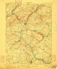
~ High Bridge NJ topo map, 1:62500 scale, 15 X 15 Minute, Historical, 1905, updated 1910
High Bridge, New Jersey, USGS topographic map dated 1905.
Includes geographic coordinates (latitude and longitude). This topographic map is suitable for hiking, camping, and exploring, or framing it as a wall map.
Printed on-demand using high resolution imagery, on heavy weight and acid free paper, or alternatively on a variety of synthetic materials.
Topos available on paper, Waterproof, Poly, or Tyvek. Usually shipping rolled, unless combined with other folded maps in one order.
- Product Number: USGS-5377276
- Free digital map download (high-resolution, GeoPDF): High Bridge, New Jersey (file size: 9 MB)
- Map Size: please refer to the dimensions of the GeoPDF map above
- Weight (paper map): ca. 55 grams
- Map Type: POD USGS Topographic Map
- Map Series: HTMC
- Map Verison: Historical
- Cell ID: 55322
- Scan ID: 255226
- Imprint Year: 1910
- Edit Year: 1903
- Survey Year: 1886
- Datum: Unstated
- Map Projection: Unstated
- Map published by United States Geological Survey
- Map Language: English
- Scanner Resolution: 600 dpi
- Map Cell Name: High Bridge
- Grid size: 15 X 15 Minute
- Date on map: 1905
- Map Scale: 1:62500
- Geographical region: New Jersey, United States
Neighboring Maps:
All neighboring USGS topo maps are available for sale online at a variety of scales.
Spatial coverage:
Topo map High Bridge, New Jersey, covers the geographical area associated the following places:
- Cushetunk - Hoffmans - Holcomb Mills - Little Brook - Grandin - Pittstown - Anthony - Spruce Run - Mechlings Corner - Klinesville - Newport - Jutland - Changewater - Bartles Corners - Sunnyside - Flemington Junction - Fairmount - Vernoy - Oak Grove - Mount Salem - Hamden - Fairmount - Laurel Farms - Mariannes Corner - Higginsville - Kingtown - Woodfern - McCrea Mills - Norton - Rowland Mills - Whitehouse Station - Gary Corner - High Bridge - New Hampton - Dreahook - Flemington - Annandale - Polktown - McPherson - Point Breeze - Bells Crossing - Woodglen - Cherryville - Red Mill - Thachers Hill - Clinton - Stanton - Pleasant Run - Rockefellows Mills - Quakertown - Crestmoore - Readingsburg - Charlestown - Riverside - Lebanon - Franklin - Farmersville - Lansdowne - Littletown - Mountainville - Cedar Heights - Bissell - Hensfoot - Pierce Heights - Allens Corner - Lower Valley - Lower Fairmount - Hampton - Stone Mill - Croton - Potterstown - Voorhees Corner - Bunnvale - Allerton - Clarksville - Three Bridges - Sidney - Darts Mills - Perryville - Union - Hampton Junction - Alvater Corner - Califon - Centerville - Van Syckel - Cokesbury - Glen Gardner
- Map Area ID: AREA40.7540.5-75-74.75
- Northwest corner Lat/Long code: USGSNW40.75-75
- Northeast corner Lat/Long code: USGSNE40.75-74.75
- Southwest corner Lat/Long code: USGSSW40.5-75
- Southeast corner Lat/Long code: USGSSE40.5-74.75
- Northern map edge Latitude: 40.75
- Southern map edge Latitude: 40.5
- Western map edge Longitude: -75
- Eastern map edge Longitude: -74.75


