
021P10 Tracadie Canada topo map, 1:50,000 scale
021P10 Tracadie NRCAN topographic map.
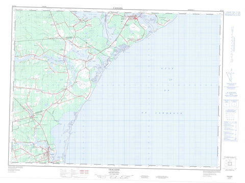
Includes UTM and GPS geographic coordinates (latitude and longitude). This 50k scale map is suitable for hiking, camping, and exploring, or you could frame it as a wall map.
Printed on-demand using high resolution, on heavy weight and acid free paper, or as an upgrade on a variety of synthetic materials.
Topos available on paper, Waterproof, Poly, or Tyvek. Usually shipping rolled, unless combined with other folded maps in one order.
- Product Number: NRCAN-021P10
- Parent Topo: TOPO-021P
- Map ID also known as: 021P10, 21P10
- Unfolded Size: Approximately 26" high by 36" wide
- Weight (paper map): ca. 55 grams
- Map Type: POD NRCAN Topographic Map
- Map Scale: 1:50,000
- Geographical region: New Brunswick, Canada
Neighboring Maps:
All neighboring Canadian topo maps are available for sale online at 1:50,000 scale.
Purchase the smaller scale map covering this area: Topo-021P
Spatial coverage:
Topo map sheet 021P10 Tracadie covers the following places:
- Baie aux Caribous - Baie Brûlé - Baie de Petit-Pokemouche - Baie de Pokemouche - Baie de Shippegan - Baie de Tracadie - Baie Saint-Simon-Nord - Baie Saint-Simon-Sud - Basse Bay - Caribou Bay - Caribou Cove - Golfe du Saint-Laurent - Golfe Saint-Laurent - Grande Anse - Gulf of St. Lawrence - Monroe Cove - Musquash Cove - Nevins Cove - North St. Simon Inlet - Patricks Cove - Shippegan Harbour - Shippigan Harbour - South St. Simon Inlet - Pokemouche Beach - Shippegan Beach - Tracadie Beach - Caribou Point - Comeaus Point - Dadys Point - Gibbs Point - Grand Passage - Green Point - Herberts Point - Indian Point - Oak Point - Paschal Point - Pointe à Allard - Pointe à Arseneau - Pointe à Bouleau - Pointe à Chaudron - Pointe à Doran - Pointe à Godin - Pointe à Landry - Pointe à Pascal - Pointe à Philippe - Pointe à Pitro - Pointe à Poulette - Pointe à Thomas - Pointe aux Bouleaux - Pointe aux Caribous - Pointe aux Rats Musqués - Pointe de Pré - Pointe des Boudreau - Pointe des Mazerolle - Pointe des Pins - Pointe Saint-Pierre - Pointe Sauvage - Rivers Point - Sandy Point - Walshs Point - Boudreau Channel - Old Gully - Old Tracadie Gully - Petit-Pokemouche Gully - Pokemouche Gully - Shippegan Gully - Shippegan Sound - Tracadie Gully - Tracadie North Gully - Caraquet - Gloucester - Inkerman - Saint-Isidore - Saumarez - Pokemouche 13 - Bandy Island - Buckley Island - Burns Island - Île à William - Île au Cheval - Île Lamèque - Munro Island - Polly Island - Sandy Island - Sandy Island - Shippegan Island - Shippigan Island - Taylor Island - Walshs Island - Barachois à Colas - Gull Lake - Lac à Finn - Lac à Martine - Lac Arnée - Lac des Losier - Lac du Goulet - Lac Frank - Lac Grégoire - Lac Inkerman - Lac Scott - Little Pokemouche Lagoon - Mare d'Anguille - Pokemouche Lagoon - Tracadie Lagoon - Inkerman Migratory Bird Sanctuary - Refuge d'oiseaux migrateurs d'Inkerman - Shippagan Provincial Park - Boutallier (Poulet) Brook - Caribou Brook - Caribou Creek - Cowans Creek - Dukes Brook - Gaspereau Creek - Gliddens Brook - Little Tracadie River - Mahers Brook - Maltampec Brook - McConnell Brook - Nowlans Brook - Pokemouche River - Rivière à Brideau - Rivière Saint-Simon - Ruisseau à Arthur Losier - Ruisseau à Auguste - Ruisseau à Canot - Ruisseau à Fidéle - Ruisseau à Isaac - Ruisseau à Jules - Ruisseau à Lumsden - Ruisseau à Maxime - Ruisseau à McLaughlin - Ruisseau à Paul - Ruisseau aux Caribous - Ruisseau Bar - Ruisseau des Mallet - Ruisseau des Vital - Ruisseau Gaspereau - Ruisseau LeBouthillier - Ruisseau Odilon - Seal Brook - South Branch Pokemouche River - South Pokemouche River - South Pokemouche River - St. Simon River - Trout Stream - Wades Brook - Walshs Brook - Waugh River - Whalens Brook - Whittys Brook - Shippagan - Shippegan - Tracadie-Sheila - Alderwood - Blanchard Settlement - Boishébert - Boudreau Road - Centre St. Simon - Centre-Saint-Simon - Chiasson - Cowans Creek - Evangeline - Évangéline - Ferguson - Four Roads - Gaspereau - Gauvreau - Haché Road - Haut-Sainte-Rose - Haut-Saint-Simon - Haut-Shippegan - Haut-Ste-Rose - Inkerman - Inkerman Ferry - Landry - Little Gaspereau - Little Tracadie - Losier Settlement - Lozier Settlement - Maltampec - Pointe-à-Bouleau - Pointe-Sauvage - Pokemouche - Pokemouche Junction - Pont-Landry - Portage de Shippagan - Rivière-à-la-Truite - Sainte-Rose-Gloucester - Saumarez - Shippegan Gully - Shippegan Gully Road - Shippegan Portage - Shippigan - Six Roads - South River - St. Simon - Ste-Rose-Gloucester - Tracadie - Trout Stream - Upper Pokemouche - Upper St. Simon - Upper Ste-Rose - Upper St-Simon - Village Blanchard - Plover Ground - Pré à Maher - Le Goulet - Shippigan


