
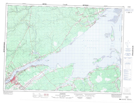
021P03 Chatham Canada topo map, 1:50,000 scale
021P03 Chatham NRCAN topographic map.
Includes UTM and GPS geographic coordinates (latitude and longitude). This 50k scale map is suitable for hiking, camping, and exploring, or you could frame it as a wall map.
Printed on-demand using high resolution, on heavy weight and acid free paper, or as an upgrade on a variety of synthetic materials.
Topos available on paper, Waterproof, Poly, or Tyvek. Usually shipping rolled, unless combined with other folded maps in one order.
- Product Number: NRCAN-021P03
- Parent Topo: TOPO-021P
- Map ID also known as: 021P03, 21P3, 21P03
- Unfolded Size: Approximately 26" high by 36" wide
- Weight (paper map): ca. 55 grams
- Map Type: POD NRCAN Topographic Map
- Map Scale: 1:50,000
- Geographical region: New Brunswick, Canada
Neighboring Maps:
All neighboring Canadian topo maps are available for sale online at 1:50,000 scale.
Purchase the smaller scale map covering this area: Topo-021P
Spatial coverage:
Topo map sheet 021P03 Chatham covers the following places:
- Baie du Vin - Baie Sainte-Anne - Bay du Vin - Bay du Vin - Bay du Vin Harbour - Big Cove - Gammon Bay - Grand Dune Inlet - Havre du Vin - Mill Cove - Miramichi Bay - Miramichi Bay - Miramichi Inner Bay - Morrison Cove - Murdock Cove - Napan Bay - Neguac Bay - Palmer Cove - Sturgeon Cove - Grant Beach - Horse Shoe Bar - Miramichi Beaches - Murdock Beach - Neguac Beach - Washburn Beach - Burnt Church Point - Cheval Point - East Point - Forbes Point - French River Point - Gammon Point - Gardiner Point - Gardiner Spit - Gordon Point - Malcolm Point - McDonald Point - Moody Point - Morin Point - Murdoch Point - Oak Point - Point au Car - Point aux Carr - Point Gardiner - Pointe Morin - Potts Parlour - Robichaud Spit - Rocky Point - St. Andrew Point - St. Andrews Point - French Channel - Neguac Gully - Oak Channel - Portage Gully - Portage Island Channel - Sheldrake Channel - Ship Channel - Miramichi - Alnwick - Chatham - Glenelg - Hardwicke - Newcastle - Northumberland - Burnt Church 14 - Bartibog Island - Bay du Vin Island - Egg Island - Fox Island - Grand Dune Island - Hay Island - Lower Portage Island - Middle Island - Portage Island - Sheldrake Island - Chatham Lake - Chatham Reservoir - Dry Lake - Neguac Lagoon - Ancien presbytère St. Michael's - Bay du Vin Island Provincial Park Reserve - Église Saints Peter and Paul - Ferme MacDonald - Girouard Shipwreck Site - Lieu de naufrage Girouard - MacDonald Farm - Middle Island Provincial Park - Neguac Provincial Park - Old St. Michael's Rectory - Portage Island National Wildlife Area - Réserve nationale de faune de l'Île-Portage - Saints Peter and Paul Church - Anderson Brook - Bartibog River - Bay du Vin River - Big Brook - Big Brook - Black Brook - Black River - Burnt Church River - Coltarts Brook - Dennison Creek - Doyles Brook - East Branch Hortons Creek - East Branch Oyster River - Eel River - French River - Gallows Brook - Godins Brook - Goodfellows Brook - Grand Dune Brook - Green Brook - Greystone Brook - Hortons Creek - Indian Brook - Indian Brook - Little Bartibog River - Little Black River - Lyons Brook - McDonald Brook - McEwen Brook - McInnis Brook - Meadow Brook - Mill Brook - Mill Cove Brook - Miramichi River - Murdoch Brook - Murdock Brook - Nadeau Brook - Napan River - Nidoos Creek - North Branch Burnt Church River - North Branch Little Bartibog River - North Burnt Church River - North Little Bartibog River - Oyster River - Oyster River - Phillips Brook - Reserve Brook - Rivière des Caches - Rivière du Cache - Rivière du Vin - Robichaud Brook - Robichaud Creek - South Branch Burnt Church River - South Branch Little Bartibog River - South Burnt Church River - South Little Bartibog River - Sturgeon Creek - Taylor Creek - Wells Brook - West Branch Hortons Creek - West Branch Oyster River - West Oyster River - Whites Brook - Wildcat Brook - Youngs Brook - Grand Dune Flats - Horse Shoe Shoal - Leggett Shoal - Middle Ground - Miramichi Bar - Spit Shoal - St. Andrew Bank - St. Andrews Bank - Auburnville - Barryville - Bartibog - Bartibog Bridge - Bay du Vin - Bay du Vin Beach - Black River Bridge - Burnt Church - Centre Napan - Chatham - Curtis Park - Douglastown - Drisdelle Settlement - Eel River Bridge - Ferry Road - Forest Corner - Fowlies Mill - Gregan - Hardwicke - Hexham - Hortons Creek - Lagacéville - Little Bartibog - Little Branch - Loggieville - Lower Napan - Lower Newcastle - Millbank - Miramichi - Moorefield - Morrison Cove - Napan Bay - New Jersey - Oak Point - Point au Car - Point aux Carr - Point Gardiner - Pointe au Quart - Rivière des Caches - Rivière-des-Caches - Robichaud Settlement - Russellville - The Willows - Upper Burnt Church - Upper Napan - Victoria - Village-Saint-Laurent - Village-St-Laurent - Winston - Neguac


