
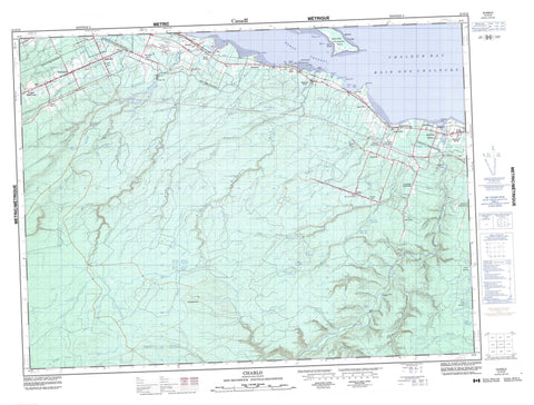
021O16 Charlo Canada topo map, 1:50,000 scale
021O16 Charlo NRCAN topographic map.
Includes UTM and GPS geographic coordinates (latitude and longitude). This 50k scale map is suitable for hiking, camping, and exploring, or you could frame it as a wall map.
Printed on-demand using high resolution, on heavy weight and acid free paper, or as an upgrade on a variety of synthetic materials.
Topos available on paper, Waterproof, Poly, or Tyvek. Usually shipping rolled, unless combined with other folded maps in one order.
- Product Number: NRCAN-021O16
- Parent Topo: TOPO-021O
- Map ID also known as: 021O16, 21O16
- Unfolded Size: Approximately 26" high by 36" wide
- Weight (paper map): ca. 55 grams
- Map Type: POD NRCAN Topographic Map
- Map Scale: 1:50,000
- Geographical region: New Brunswick, Canada
Neighboring Maps:
All neighboring Canadian topo maps are available for sale online at 1:50,000 scale.
Purchase the smaller scale map covering this area: Topo-021O
Spatial coverage:
Topo map sheet 021O16 Charlo covers the following places:
- Baie des Chaleurs - Canning Cove - Chaleur Bay - Dickie Cove - McKinnon Cove - Razor Cove - Shoal Bay - Fenderson Beach - Black Head - Black Land Point - Black Point - Blackland Point - Bryant Point - Bryants Point - Dickie Point - Douglas Point - Dutchs Point - Hamilton Point - Hoeggs Point - Parent Point - Parents Point - Pointe la Roche - Pointe La Roche - Valette Point - West Point - West Point - Heron Channel - McKinnon Falls - Balmoral - Colborne - Dalhousie - Durham - Restigouche - Cricket Island - Fleming Island - Heron Island - West Point Island - Basket Lake - Hayes Lake - Henry Lake - Hickey Lake - Island Lake - Lower Jack Burns Lake - Oak Pond - Pothole Lake - Roberts Pond - Round Lake - Three Corner Lake - Upper Jack Burns Lake - Windsor Lake - Bald Mountain - Big Hole Hill - Blue Mountain - Lavignes Hill - Benjamin River Provincial Park - Heron Island Provincial Park Reserve - Davidsons Flats - Antinouri Lake Brook - Benjamin River - Benjamin River - Big Hole Brook - Big Ramsay Brook - Big Ramsay Brook - Blackland Brook - Blueberry Creek - Carr Brook - Charlo River - Connors Brook - Dickie Brook - Dickie Brook - Dickie Cove Brook - Eel Brook - Eel River - Falls Gulch Brook - Flann Brook - Hamilton Brook - Hamilton Brook - Indian Brook - Jacquet River - Lake Brook - Lake Brook - Landry Brook - Little Black Brook - Little Dickie Brook - Little Flat Landing Brook - Little McLean Brook - Little Ramsay Brook - Little Ramsay Brook - Long Pond Brook - Louison Creek - Louison River - Louison River - Lower McNair Brook - Lower South Branch Jacquet River - Lower South Jacquet River - Marks Brook - McIntoshs Brook - McLean Brook - McLean Gulch Brook - McNair Brook - McNeill Brook - Meadow Brook - Middle Branch Eel River - Middle Brook - Middle Eel River - Middle Eel River - Mountain Brook - Murchie Brook - Narrows Brook - Nash Creek - Nash Creek - New Mills Brook - New Mills River - Nigadoo River - Nigadu River - North Benjamin River - North Branch Benjamin River - North Branch Charlo River - North Branch Eel River - North Branch Nash Creek - North Branch Nigadoo River - North Charlo River - North Eel River - North Nash Creek - North Nigadoo River - Ramsay Brook - Ramsay Brook - Reid Brook - Robert Brook - Roberts Brook - Rocky Brook - South Benjamin River - South Branch Benjamin River - South Branch Eel River - South Branch Nash Creek - South Charlo River - South Eel River - South Jacquet River - South Nash Creek - Two Mile Brook - Upper McNair Brook - Wildcat Brook - Winton Gulch - Heron Rock - Seal Rock - Thrum Rock - Archibald Settlement - Becketville - Benjamin River - Bernard Settlement - Black Land - Black Point - Blackland - Charlo Station - Dickie - Doyleville - Durham Centre - Gravel Hill - Halfway - Heron Island - Hickey Settlement - Jacquet River - Jacquet River Station - Lapointe Settlement - Lorne - McMillan - Mitchell Settlement - Mountain Brook - Nash Creek - New Mills - River Charlo - River Louison - Saint-Maure - Sea Side - Selwood - St. Maure - St-Maure - Sunnyside - Upper Balmoral - Upper Crossing - Winton Crossing - Big Gulch - Carmichael Gulch - Doyle Gulch - Elfs Gulch - Gooseback Gulch - Hayes Gulch - Laviolette Gulch - Mann Gulch - Peter White Gulch - Pothole Gulch - Stinking Gulch - Doyles Meadow - Jones Meadow - Balmoral - Belledune - Charlo


