
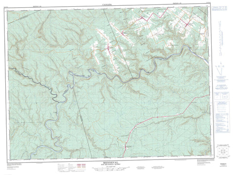
021O14 Menneval Canada topo map, 1:50,000 scale
021O14 Menneval NRCAN topographic map.
Includes UTM and GPS geographic coordinates (latitude and longitude). This 50k scale map is suitable for hiking, camping, and exploring, or you could frame it as a wall map.
Printed on-demand using high resolution, on heavy weight and acid free paper, or as an upgrade on a variety of synthetic materials.
Topos available on paper, Waterproof, Poly, or Tyvek. Usually shipping rolled, unless combined with other folded maps in one order.
- Product Number: NRCAN-021O14
- Parent Topo: TOPO-021O
- Map ID also known as: 021O14, 21O14
- Unfolded Size: Approximately 26" high by 36" wide
- Weight (paper map): ca. 55 grams
- Map Type: POD NRCAN Topographic Map
- Map Scale: 1:50,000
- Geographical region: New Brunswick, Canada
Neighboring Maps:
All neighboring Canadian topo maps are available for sale online at 1:50,000 scale.
Purchase the smaller scale map covering this area: Topo-021O
Spatial coverage:
Topo map sheet 021O14 Menneval covers the following places:
- Silas Beach - Cross Point - L'Ascension - L'Ascension - Matapédia - Patapédia - Restigouche - Roncevaux - Saint-Alexis - Saint-Alexis-de-Matapédia - Saint-François-d'Assise - Almons Island - Cross Point Island - Downs Gulch Island - Downs Gulch Islands - England Island - Gilmores Island - Greens Island - Île Greens - Île Mocklar - Ile Moklar - Île Moklar - Île Muckler's - Marshall Island - McAndrew Island - McAndrews Island - McDougalls Island - Mocklers Island - Moklar Island - Pine Island - Tracy Island - Walker Island - White Islands - Whites Brook Islands - Lac du Pin Rouge - Lacs à William-Harrisson - Glenwood Provincial Park - Heros Rapids - Beaver Brook - Beaver Brook - Blueberry Brook - Boland Brook - Cheuters Brook - Coulée à Siméon - Coulée Creuse - Falls Brook - Fraser Brook - Gilmores Brook - Grog Brook - Haffords Brook - Haffords Brook - Jardine Brook - Lower Grindstone Brook - Lower Thorn Point Brook - Lower Thornpoint Brook - Lower Two Brook - Lower Two Brooks - Meadow Brook - Miles Gulch Brook - Mill Brook - Mowat Brook - Mowats Brook - Murray Brook - Narrows Brook - North Branch Grog Brook - North Branch Tracy Brook - North Grog Brook - North Tracy Brook - Otter Brook - Patapedia River - Patapédia River - Petit ruisseau Brandy - Petit ruisseau Thomas - Ravin Brûlé - Ravin Dubé - Restigouche River - Restigouche River - Rivière Patapédia - Rivière Patapédia Ouest - Rivière Restigouche - Rivière Ristigouche - Rivière Ristigouche - Robinson Brook - Ross Brook - Ruisseau André-Fidèle - Ruisseau Armand-Guénette - Ruisseau Basile - Ruisseau Big Indian - Ruisseau Brandy - Ruisseau Chaîne de Rochers - Ruisseau Chamberland - Ruisseau Chamberland Ouest - Ruisseau de la Cabane du Sauvage - Ruisseau de la Chaîne de Roches - Ruisseau de la Chaîne des Roches - Ruisseau de la Station - Ruisseau de l'Indien - Ruisseau des Quatre Milles - Ruisseau des Trois Milles - Ruisseau du 3e Mille - Ruisseau du 4e Mille - Ruisseau du Crapaud - Ruisseau du Pin Rouge - Ruisseau du Pot - Ruisseau du Sauvage - Ruisseau Dubé - Ruisseau Ferguson - Ruisseau Ferguson Nord - Ruisseau Fivemile - Ruisseau Gordon - Ruisseau Indian House - Ruisseau le Crapaud - Ruisseau Marshall - Ruisseau McKenzie - Ruisseau Mocklar - Ruisseau Moklar - Ruisseau Red Pine - Ruisseau Robitaille - Ruisseau Saint-Alexis - Ruisseau Thomas - Snake Brook - South Branch Grog Brook - South Branch Tracy Brook - South Grog Brook - Stillwater Brook - Thornpoint Brook - Tracy Brook - Tracy Brook - Upper Grindstone Brook - Upper Thorn Point Brook - Upper Two Brook - Upper Two Brooks - Walker Brook - Whale Back Brook - Whales Back Brook - White Brook - Whites Brook - Wyers Brook - Fosse de la Cabane de Wyer - Fosse de la Dernière Chance - Fosse de la Salière du Chevreuil - Fosse des Bassins - Fosse des Trois Îles - Fosse du 2e Mille - Fosse du 4e Mille - Fosse du 5e Mille - Fosse du Cèdre - Fosse du Grand Indien - Fosse du Rapide de l'Île - Fosse du Rapide McNight - Fosse du Ravin Brûlé - Fosse du Sentier - Fosse Gooderich - Fosse Jumeau - Fosse Jumeau d'en Bas - Fosse Price - La Cabane de Wyer - La Dernière Chance - La Salière de Chevreuil - Le Cèdre - Le Cinq Milles - Le Deux Milles - Le Grand Indien - Le Jumeau - Le Jumeau du Bas - Le Quatre Milles - Le Rapide de l'Île - Le Rapide McNight - Le Ravin Brûlé - Le Sentier - Les Bassins - Les Trois Îles - Marshalls Gulch Stretch - Bulls Head Rock - Chamberland Shoals - Adams Gulch - Barberie - C.C. Siding - Canton-Patapédia - Glenwood - Grog Brook Dam - L'Ascension-de-Patapédia - Léonard-de-Matapédia - L'Immaculée-Conception - Menneval - Millerville - Rock Mill - Saint-Alexis-de-Matapédia - Saint-Benoît-de-Matapédia - Saint-François-d'Assise - Saint-Jean-Baptiste-de-Restigouche - Saint-Jean-de-Matapédia - Saint-Jean-de-Matapédia - Saint-Joseph-de-Matapédia - Saint-Laurent - St-Jean-Baptiste-de-Restigouche - Adams Gulch - Bologna Gulch - Downs Gulch - Eight Mile Gulch - Five Mile Gulch - Greys Gulch - Lower Downs Gulch - McAndrews Gulch - Murray Gulch - L'Ascension-de-Patapédia - Matapédia - Saint-Alexis-de-Matapédia - Saint-François-d'Assise - Saint-Laurent-de-Matapédia


