
021J15 Tuadook Lake Canada topo map, 1:50,000 scale
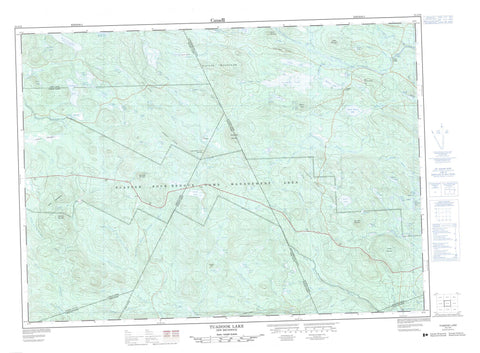
021J15 Tuadook Lake NRCAN topographic map.
Includes UTM and GPS geographic coordinates (latitude and longitude). This 50k scale map is suitable for hiking, camping, and exploring, or you could frame it as a wall map.
Printed on-demand using high resolution, on heavy weight and acid free paper, or as an upgrade on a variety of synthetic materials.
Topos available on paper, Waterproof, Poly, or Tyvek. Usually shipping rolled, unless combined with other folded maps in one order.
- Product Number: NRCAN-021J15
- Parent Topo: TOPO-021J
- Map ID also known as: 021J15, 21J15
- Unfolded Size: Approximately 26" high by 36" wide
- Weight (paper map): ca. 55 grams
- Map Type: POD NRCAN Topographic Map
- Map Scale: 1:50,000
- Geographical region: New Brunswick, Canada
Neighboring Maps:
All neighboring Canadian topo maps are available for sale online at 1:50,000 scale.
Purchase the smaller scale map covering this area: Topo-021J
Spatial coverage:
Topo map sheet 021J15 Tuadook Lake covers the following places:
- Cow Bay - Left Hand Leg - Right Hand Leg - The Jaws - Indian Falls - Southesk - Bear Lake - Beaver Lake - Berton Lake - Billings Lake - Braithwaite Lake - Burk Lake - Burton Lake - Cabot Lake - Caribou Lake - Carson Lake - Chestnut Lakes - Clark Lake - Clearwater Lake - Costigan Lake - Crane Lake - Deer Lake - Depot Lake - Duck Lake - Feigenspan Lakes - First Fish Lake - First Fowler Lake - First Lake - Fish Lake - Fish Lakes - Forty Seven Lake - Fox Lake - Furbish Pond - Geordie Lake - Grassy Lake - Gray Lake - Gulquac Lake - Halfmoon Lake - Holmes Lake - Indian Lake - Indian Lake - Irland Pond - Island Lake - Jacks Lake - Joe Lake - Kennedy Lakes - Kipler Lake - Lake Brook Lake - Little Bear Lake - Little Indian Lake - Lost Beaver Lake - Louis Lake - Lower Billings Lake - Lower Kennedy Lake - Melville Lake - Merrithew Lake - Moccasin Lake - Moose Lake - Mud Lake - Mud Lake - Mud Lake - Nealis Lake - North Renous Lake - Ogilvie Lake - Ogilvie Lakes - Parker Lake - Peaked Mountain Lake - Peaked Mountain Lakes - Peanut Lake - Pear Lake - Peeked Mountain Lakes - Pocket Lake - Reeds Brook Lake - Reeds Lake - Reid Lake - Round Pond - Rumsey Lake - Second Fish Lake - Smiths Lake - Spider Lake - Squaw Lake - Townsend Pond - Trousers Lake - Trout Lake - Tuadook (Little Southwest Miramichi) Lake - Tuadook Lake - Twin Lakes - Upper Kennedy Lake - Upper Long Lake - Upper Peaked Mountain Lake - Yellow Lakes - Young Bull Lake - Bertons Ridge - Braithwaite Mountain - Carson Hill - Clearwater Mountain - Divide Mountains - Fowler Mountain - Fox Ridge - Little County Line Mountain - Lyles Mountain - Martins Bluff - Redstone Mountain - Risteen Mountains - Robinson Ridge - Rumsey Ridge - Shunabit Mountain - Smiths Mountain - The Horseback - Bamford Brook - Country Line Brook - Crooked Brook - Dungarvon River - Dungarvon River - Fairley Brook - Fall Brook - Fish Brook - Forty Seven Brook - Fox Brook - Gulch Brook - Gulquac River - Indian Brook - Irland Brook - Lake Branch Gulquac River - Lake Brook - Lake Brook - Lake Brook - Lake Brook - Left Hand Branch River de Chute - Little Dungarvon River - Little North Branch Renous River - Little North Pole Brook - Little Northeast Branch Clearwater Brook - Little Northeast Clearwater Brook - Little Ottawa Branch - Little Southwest Miramichi River - Mains Brook - McCoy Brook - North Branch Burnthill Brook - North Branch Dungarvon River - North Branch of Burnt Hill Brook - North Branch Renous River - North Burnthill Brook - North Dungarvon River - North Renous River - Northeast Branch Clearwater Brook - Northeast Clearwater Brook - Northwest Branch Little Southwest Miramichi River - Northwest Inlet - Pond Brook - Redstone Brook - Reeds Brook - South Branch Dungarvon River - South Branch Renous River - South Dungarvon River - South Renous River - Squaw Barren Brook - Stone Brook - Trafton Brook - Tuadook River - Turnbull Brook - Twin Lakes Brook - Wapskehegan River - West Branch Little Southwest Miramichi River - Yellow Brook - Big Deadwater - Crooked Deadwater - Gulquac Deadwater - Long Deadwater - Lower Deadwater - Mud Lake Deadwater - Smiths Forks - Upper Forks - Licford - Loggie Lodge - Pratts Camp - Rough Gulch - Squaw Barren - Trafton Barrens


