
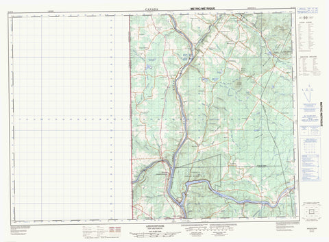
021J13 Aroostook Canada topo map, 1:50,000 scale
021J13 Aroostook NRCAN topographic map.
Includes UTM and GPS geographic coordinates (latitude and longitude). This 50k scale map is suitable for hiking, camping, and exploring, or you could frame it as a wall map.
Printed on-demand using high resolution, on heavy weight and acid free paper, or as an upgrade on a variety of synthetic materials.
Topos available on paper, Waterproof, Poly, or Tyvek. Usually shipping rolled, unless combined with other folded maps in one order.
- Product Number: NRCAN-021J13
- Parent Topo: TOPO-021J
- Map ID also known as: 021J13, 21J13
- Unfolded Size: Approximately 26" high by 36" wide
- Weight (paper map): ca. 55 grams
- Map Type: POD NRCAN Topographic Map
- Map Scale: 1:50,000
- Geographical region: New Brunswick, Canada
Neighboring Maps:
All neighboring Canadian topo maps are available for sale online at 1:50,000 scale.
Purchase the smaller scale map covering this area: Topo-021J
Spatial coverage:
Topo map sheet 021J13 Aroostook covers the following places:
- Big Flat - Indian Point - Denmark - Grand Falls - Tobique 20 - Back Lake - Bear Lake - Blue Bell Lake - Costigan Lake - Lake Edward - Mazerolle Lake - McCullion Lake - Merritt Lake - Mud Lake - Pettingill Lake - Piries Lake - Pokiok Lake - Round Lake - Toad Pond - Blue Bell Mountain - Burnt Hill Mountain - Cameron Mountain - Cameron Mountain Range - Foundry Ridge - Geneau Mountain - Horseback Hill - Klokledahl Hill - Tompkins Ridge - Ancienne église unie St. James - Former St. James United Church - Aroostook River - Bear Brook - Beaver Brook - Big Flat Brook - Blue Bell Brook - Boutot Brook - Brinkman Brook - Caldwell Brook - Caldwell Brook - Caldwell Brook - Caribou Brook - Celmo Brook - Cochrane Brook - Craig Brook - Curry Brook - Dead Brook - Demerchant Brook - DeMerchant Brook - Dixon Brook - Dyers Brook - East Branch Limestone Stream - East Branch Pokiok River - East Limestone River - Falls Brook - Finnemore Brook - Four Falls Stream - Gallagher Brook - Gillespie Brook - Godin Brook - Graham Brook - Indian Brook - Johnston Brook - Jones Brook - Keating Brook - Lake Branch River - Left Branch Brook - Left Branch Pokiok River - Left Hand Branch Blue Bell Brook - Left Hand Branch Caldwell Brook - Left Hand Branch Pokiok River - Left Hand Branch Trout Brook - Left Hand Trout Brook - Limestone River - Limestone Stream - Little River - Little Salmon River - McGillen Brook - Merritt Brook - Mill Brook - Narrows Brook - Neilson Brook - Odellach River - Outlet Brook - Pelky Brook - Perkins Brook - Plante Brook - Pokiok River - Quaker Brook - Rasmussen Brook - Right Branch Brook - Right Hand Branch Blue Bell Brook - Right Hand Branch Caldwell Brook - Rivière Saint-Jean - Roberts Brook - Rodgers Brook - Saint John River - Salmon River - Salmonhurst Brook - Snaiky Brook - Snakity Brook - Streets Brook - Tibbits Brook - Tibbitts Brook - Toad Pond Brook - Tobique River - Trout Brook - West Caldwell Brook - West Caldwell Brook - Anderson Road - Andover - Anfield - Argosy - Aroostook Junction - Aroostook Portage - Bell Grove - Blue Bell - Blue Bell Corner - Caldwell Brook - California - Carlingford - Cliffordvale - Costigan - Currie - Currie Road - Davis - Four Falls - Gillespie - Gillespie Settlement - Gladwyn - Grand Falls Portage - Hazeldean - Hilldale Corner - Hillside - Lake Edward - Lerwick - Licford - Limestone - Lower California - Lower Portage - Maliseet - McCluskey - Medford - Millicete - Morrell - Morrill - New Denmark - New Denmark - New Denmark Corner - New Denmark Station - North Tilley - Ortonville - Pearl - Piccadilly - Quaker Brook - Ranger Settlement - Red Rapids - Rowena - Salmonhurst - Salmonhurst Corner - South Tilley - Tilley - Tinker - Tobique Narrows - Tobique River - Turner Settlement - Undine - Upper California - Yone - Dry Gulch - Lucys Gulch - Andover-Perth - Aroostook - Perth - Perth-Andover


